Hidden Nature Spots in Western Serbia for Hikers: 8 Quiet Trails & Viewpoints

Hidden Nature Spots in Western Serbia for Hikers are easiest to find one trail beyond the region’s headline attractions. Banjska Stena, Uvac Canyon, and central Zlatibor are worth seeing, but quieter routes such as Bilješka Stena, Rača–Lađevac, Zlatar, Radoinja Lake, Golija, and parts of the Ovčar–Kablar Gorge are a better match for hikers looking for less-touristed landscapes.
This guide focuses on places where the walking itself matters. Some are fully marked mountain trails; others are quiet protected landscapes where you should use official GPX files, recent local information, or a clearly defined trail rather than assuming every dirt road is a hiking route.
Western Serbia is not “untouched wilderness” in the literal sense. Tara, Zlatibor, and Uvac are established tourism destinations. The quieter experience comes from choosing the right trail, the right access point, and the right time of day—not from pretending the region is unknown.
Affiliate note: this article contains a small number of travel links only where they are directly useful for car rental, accommodation, or mobile data.
Table of Contents
Hidden Nature Spots in Western Serbia for Hikers: Quick Comparison
| Place | Best For | Difficulty | Why It Feels Quieter |
|---|---|---|---|
| Bilješka Stena, Tara | Forest walking + Drina views | Easy to moderate depending route | Less crowded than Banjska Stena |
| Rača–Lađevac, Tara | Short riverside hike | Easy | Compact trail away from major viewpoints |
| Krstac–Molitva, Uvac | Canyon hiking + vultures | Moderate | Real hiking route rather than drive-up sightseeing |
| Radoinja Lake | Quiet lakeside nature | Easy / flexible | More secluded than Uvac’s headline viewpoints |
| Zlatar | Longer forest and meadow hikes | Varies | Far fewer visitors than Zlatibor |
| Golija Nature Park | Remote mountain landscapes | Varies, often moderate | Large protected area with low visitor density |
| Banjski Potok, Ovčar–Kablar | Waterfalls and canyon scenery | Route-dependent | Overshadowed by Kablar viewpoints |
| Zlatibor marked trails | Easy access and graded routes | Easy to very demanding | Quiet once you leave the resort center |
If you have only one day, choose Tara. If you have three to five days, combine Tara with Uvac/Zlatar and one less-visited mountain area such as Golija or Ovčar–Kablar.
First: Tara’s Trail Network Is Being Reconstructed
Tara National Park remains one of the best hiking areas in Serbia, with around 290 km of marked hiking trails. But there is an important current update: the park says the hiking network is under reconstruction, and directional signposts have been removed during the work.
The official advice is to use the park’s GPX files with a suitable navigation app instead of relying only on signs at junctions.
Check the latest trail information on the official Tara National Park hiking page before setting out.
This is especially important because older articles still describe Tara as a place where every route is straightforward to follow simply because the trails are marked. The red-and-white hiking marks still matter, but temporary missing directional signage changes how confidently you should navigate unfamiliar intersections.
Another Correction: Tara Does Not Have “Hidden Glacial Lakes”
Zaovine and Perućac are reservoirs, not glacial lakes. They are beautiful landscapes for walking and photography, but they should be described accurately. Tara’s appeal comes from forests, Drina canyon viewpoints, river valleys, reservoirs, wildlife habitat, and marked mountain routes—not alpine glacial lakes.
1. Bilješka Stena: The Quieter Tara Viewpoint
Banjska Stena is the famous Tara viewpoint. Bilješka Stena is the better choice if you want a quieter forest approach and a viewpoint that still delivers a major Drina landscape.
Bilješka Stena lies near the edge of the Zvijezda reserve area at about 1,225 meters. The route from Predov Krst is listed by the Mountaineering Association of Serbia at 6 km, while local tourism information also identifies the viewpoint as roughly 6 km from Predov Krst via a macadam road and hiking route.
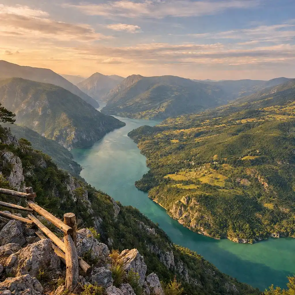
The viewpoint looks toward Lake Perućac, the Drina valley, and Bosnia and Herzegovina. It is also one of the areas where you may see Pančić spruce, the rare conifer strongly associated with Tara.
Why Choose Bilješka Stena Over Banjska Stena?
- It receives less casual sightseeing traffic.
- The forest approach feels more like a hike than a famous-viewpoint visit.
- Predov Krst is a useful base for the quieter northwestern part of Tara.
- You still get a major Drina/Perućac panorama.
Do not interpret “6 km” as automatically meaning a 6 km round trip. Route descriptions use different conventions. Download the current route or confirm your planned turnaround before walking.
If your priority is a quieter Tara day, Bilješka Stena is one of the strongest matches in this entire guide.
2. Rača Monastery to Lađevac: Short, Easy and Underrated
Not every hidden nature spot needs to be remote or physically demanding. The route from Rača Monastery to Lađevac is one of Tara’s best short walks for hikers who want forest, river scenery, and a natural spring without committing to a full-day mountain route.
Planinarski Klub Tara lists the marked route at approximately:
- Length: 2.2 km
- Fitness difficulty: 1/10
- Technical difficulty: 2/10
- Cumulative ascent: around 170 m
- Expected one-way time: around 30 minutes
A 2026 local Tara tourism update also describes an easy two-kilometer walk upstream from the monastery along the Rača River toward Lađevac and the entrance to the Rača canyon.
This is a strong alternative to spending every Tara day chasing elevated viewpoints. The experience is intimate: beech forest, river sound, shade, and a cultural starting point at one of the region’s important monasteries.
Who Is It Best For?
- Travelers arriving late in the day.
- Families wanting a real trail without a hard climb.
- Hikers recovering after a longer Tara route.
- Anyone visiting Rača Monastery who wants more than a car-stop experience.
For navigation, prefer a current Tara or mountaineering-club GPX rather than an old community recording.
3. Uvac: Hike to Molitva Instead of Treating It as a Photo Stop
Uvac is not hidden. The famous meanders are among Serbia’s most recognizable nature images. But you can still experience the reserve as a hiker rather than as someone who simply drives to a viewpoint or joins a boat tour.
The official Uvac Reserve currently describes a walking route from Krstac to Molitva viewpoint:
- One-way distance: about 6 km
- Return distance: about 12 km
- Typical return time for average fitness: around 3.5–4 hours
- Character: attractive rather than highly strenuous
- Access: visitors should announce the visit and buy the reserve entrance ticket
You can check current visit arrangements on the official Uvac Reserve visitor page.
The trail follows the edge of Uvac/Sjenica Lake and gives repeated opportunities to watch griffon vultures and other birds before reaching the famous Molitva panorama.
Molitva vs Veliki Vrh
Molitva is the iconic choice, but the reserve also maintains routes toward Ravni Krš and Veliki Vrh. Its current visitor information describes an approximately 7–8 km one-way option toward those viewpoints, or roughly 15 km return.
If you want a true hiking day, choose one viewpoint route and complete it on foot. If you want a mixed experience, Uvac also offers boat-and-hike combinations. Do not try to turn a full hike, cave visit, long boat trip, and multiple viewpoints into one rushed day.
About the Griffon Vultures
Uvac is one of Serbia’s most important griffon-vulture habitats and supports a major breeding population. Wild birds do not appear on demand, so treat sightings as part of the landscape rather than a guaranteed attraction.
4. Radoinja Lake: A Quieter Uvac Landscape
If Molitva is too famous to fit your idea of “hidden,” continue exploring the Uvac system at Radoinja Lake.
Western Serbia’s regional tourism organization describes Radoinja as the most serene of the three Uvac lakes, partly because it sits away from the main road. The reservoir is about 11 km long and lies between steep limestone banks.
This is not the place to promise one standardized circular hiking trail. Its value is flexibility: quiet road walking, short exploratory walks, shoreline viewpoints where access is public, kayaking, swimming in appropriate conditions, and a much lower-key atmosphere than the most photographed part of Uvac.
Why It Works for Hikers
- Excellent recovery day after a longer Uvac route.
- Useful base for combining walking with kayaking.
- More peaceful than Molitva during busy summer weekends.
- Close enough to combine with Zlatar.
Because shoreline access can change between roads, private property, steep banks, and reservoir infrastructure, use a defined local route rather than trying to “walk around the lake.”
5. Zlatar: The Mountain Many Visitors Drive Past
Zlatar is one of the clearest answers to the “where can I hike somewhere quieter than Zlatibor?” question.
Western Serbia’s tourism organization lists three hiking trails totaling 33 km across the mountain. Routes reach areas such as Vodena Poljana, Golo Brdo, Vilovi, Komarani, Rastoka, Tikva, and Kamenica.
The highest summit, Golo Brdo, reaches 1,627 meters. The broader landscape alternates between conifer forest, meadows, mountain settlements, and views toward the Uvac area.
Why Zlatar Feels Different from Zlatibor
- Much less resort development.
- Fewer large visitor attractions.
- Better connection between hiking and rural mountain scenery.
- Easy to combine with Uvac without sleeping in a busy tourist center.
Use Nova Varoš or the Zlatar accommodation area as a base, then choose a specific marked trail according to distance and weather. Do not assume every forest road is part of the 33 km official hiking network.
If your trip is built around Tara, Uvac, and Zlatar, having your own car is very useful because the trailheads and accommodation areas are spread out. You can compare car rentals in Belgrade on Discover Cars. Check fuel policy, deposit, mileage, and any road restrictions before booking.
6. Golija Nature Park: Western Serbia for People Who Really Want Space
Golija is one of the strongest wilderness-style alternatives in western and southwestern Serbia, yet it appears far less often in first-time Serbia itineraries than Tara, Uvac, or Zlatibor.
Golija Nature Park covers about 75,183 hectares. Part of the protected area—approximately 53,804 hectares—is recognized by UNESCO as the Golija–Studenica Biosphere Reserve.
The landscape includes extensive forest, streams, peatland environments, remote villages, and small mountain lakes such as Dajićko and Košaninovo. This is the kind of place where the destination is the wider protected landscape rather than one famous viewing platform.
Why Golija Is More Demanding to Plan
- Trail information is less tourist-oriented than Tara or Zlatibor.
- Road access can be slower.
- Weather can change rapidly at elevation.
- Some routes are better planned with local mountaineering information.
- Mobile coverage can be less reliable in remote valleys.
That is exactly why Golija appeals to hikers who want fewer crowds. But “quiet” should not be confused with “easy.” Download maps offline, ask your accommodation about current road and trail conditions, and avoid committing to an unverified route late in the day.
Who Should Choose Golija?
Golija suits travelers who enjoy forest hiking, long quiet days, remote guesthouses, and flexible exploration more than famous Instagram viewpoints. If you need frequent cafés, highly developed trailheads, and a constant stream of signs, stay with Tara or Zlatibor.
7. Banjski Potok in Ovčar–Kablar Gorge
Ovčar–Kablar is best known for the dramatic meanders of the West Morava and the climb to Kablar viewpoints. But one of the more interesting lower-profile nature areas is Banjski Potok.
The Čačak tourism organization describes Banjski Potok as a “hidden pearl of nature”, highlighting canyon-like terrain, several waterfalls, and a large tufa terrace.
The area is reached from the Ovčar Banja side, near the route toward the camping area. Because this is a stream-and-canyon environment rather than a polished urban walking path, conditions can change with water level, vegetation, mud, and weather.
I would treat it as a local nature walk where recent conditions matter, not publish one rigid hiking time that remains “correct” forever.
What About Kablar?
Kablar is excellent, but it is not automatically easy. Several official Ovčar–Kablar hiking routes are demanding. Some summit/viewpoint routes require steep ascent, and the Ratkova Staza viewpoint in particular is described by local tourism authorities as steep, very demanding, and risky for less experienced hikers.
Choose Kablar when you want a mountain hike. Choose Banjski Potok when you want a quieter lower-level nature stop.
8. Zlatibor: Use the Official Difficulty Ratings, Not the Resort Reputation
Zlatibor is not hidden. Its center is one of Serbia’s most developed mountain resorts. But the hiking network becomes much quieter once you move away from Kraljev Trg and the busiest attractions.
The most important correction is this: Zlatibor is not one uniformly “easy family hiking” area. The official tourism organization lists routes from easy paved walks to very demanding mountain trails.
Easy: Center to Šumatno Brdo Monument
The official route is approximately 2.3 km one way, with around 90 m of total ascent, and is classified as less demanding. It is marked and mostly paved.
This is a good first-day walk, but it is not a “hidden wilderness” experience.
Easy: Kamalj
Kamalj is a short marked route of about 1.6 km through the developed area. It is useful for families, beginners, or a morning walk before driving elsewhere.
Demanding: Center to Čuker / Čigota Direction
The official Center–Čuker route is about 5 km one way, gains roughly 615 m, and is classified as very demanding. The published description estimates roughly three hours to Čuker at a normal hiking pace.
Very Demanding: Tornik–Čigota
The official tourism site also classifies the Tornik–Čigota route as very demanding. It covers about 5 km one way through ridge and forest terrain.
So if you are traveling with children, choose the route—not the destination name. “Zlatibor” can mean a stroller-friendly paved walk or a demanding mountain trail.
You can review the current marked routes on the official Zlatibor hiking page.
Places Worth Seeing but Not Really “Hidden Hiking Spots”
Several places from older Western Serbia guides are excellent attractions but do not deserve to dominate an article about hidden hiking.
Banjska Stena
Absolutely worth visiting, especially on a first trip to Tara. But it is one of the park’s best-known viewpoints, not a secret trail.
Drina River House
The famous house on the rock near Bajina Bašta is a fun roadside/photo stop. It is not a hiking destination and does not need a full section in a hiking guide.
Gostilje Waterfall
Gostilje is a developed visitor attraction with arranged paths, facilities, and ticketed access. It can be a pleasant easy nature stop, but it is not hidden wilderness.
Stopića Cave
Another worthwhile Zlatibor attraction, but primarily a managed cave visit rather than a hiking objective.
These places can still fit a road trip. They just should not be presented as the core answer to someone searching for quieter hiking.
How to Choose a Base
| Base | Best For | Trade-Off |
|---|---|---|
| Bajina Bašta / Tara | Tara, Rača, Drina viewpoints | Long drive to Uvac/Zlatar |
| Mitrovac / Kaluđerske Bare | Staying inside Tara | Fewer town services |
| Nova Varoš / Zlatar | Uvac, Zlatar, Radoinja | Far from Tara |
| Zlatibor | Facilities, easy marked walking, day trips | Most commercial and busiest base |
| Ivanjica / Golija area | Golija exploration | More remote logistics |
| Ovčar Banja | Ovčar–Kablar routes | Less central for the rest of Western Serbia |
For a first multi-day hiking trip, I would use two bases rather than one: Tara/Bajina Bašta for the northern area and Nova Varoš/Zlatar for Uvac and Zlatar.
If you prefer hotel-style facilities and easier logistics, you can compare accommodation in Zlatibor on Agoda, then use the resort as a base for selected trail days. For a genuinely quiet hiking trip, rural guesthouses closer to Tara, Zlatar, or Golija may suit the search intent better.
Do You Need a Car?
For one trail in Tara, no. For a multi-area Western Serbia hiking itinerary, a car is extremely useful.
Public transport connects larger towns, but many trailheads sit away from regular bus corridors. The problem is especially obvious when you want to combine Predov Krst, Uvac, Radoinja, Zlatar, and Golija.
- Confirm the final road section before assuming a normal car can reach every trailhead.
- Do not drive onto unmarked forest roads simply because a map app shows a line.
- Park without blocking forestry, farm, or emergency access.
- Download offline navigation before leaving towns.
You do not automatically need an SUV. Most standard tourist approaches can be handled with a normal car in good conditions, but rough rural access can vary after heavy rain or roadworks.
Navigation: Use Current GPX, Not Confidence
The most dangerous sentence in an outdoor travel article is “the trail is easy to follow” when the writer has not checked current conditions.
For Western Serbia, use this hierarchy:
- Official national park / reserve trail information.
- Official or recognized mountaineering-club GPX.
- Current visitor-center advice.
- Recent community tracks only as additional context.
Tara currently makes this especially important because directional signposts have been temporarily removed during trail-network reconstruction.
If you want mobile data for maps and contacting accommodation, you can compare Serbia eSIM options on Airalo. Still download your GPX and offline map before leaving the trailhead.
Best Time to Hike Western Serbia
May–June
Excellent for green forests, waterfalls, and moderate temperatures. Expect mud after heavy rain and check higher routes after a cold spring.
July–August
Long daylight helps with big hiking days, but heat can be strong on exposed Uvac and Zlatibor routes. Start early and carry more water than a short map distance might suggest.
September–October
Often the most attractive period for forest hiking. Tara and Golija can be particularly beautiful in autumn. Days are shorter, so do not use midsummer start times for long routes.
Winter
This guide is not a winter-hiking route guide. Snow and ice change both technical difficulty and road access. Use winter-specific local information if traveling outside the normal hiking season.
Wildlife and Trail Safety
Western Serbia supports brown bears, wolves, wild boar, deer, birds of prey, and many smaller species. That is a reason to hike responsibly, not to sensationalize the region.
- Make normal human noise in dense vegetation.
- Do not approach wildlife for photos.
- Never feed animals.
- Keep food and rubbish with you.
- Check for ticks after grassy routes.
- Carry sufficient water.
- Tell someone your route if hiking alone.
- Use Serbia’s emergency number 112 when appropriate.
Do not rely on claims such as “bear attacks do not happen” or assume wildlife will avoid every trail. The sensible goal is predictable behavior: stay on your route, avoid surprising animals, and follow park instructions.
A Realistic 3-Day Hiking Plan
Day 1 — Quieter Tara
Base yourself in Tara or Bajina Bašta. Choose Bilješka Stena as the main route, then stop at Banjska Stena only if you still want the famous view and have enough daylight.
If you prefer an easier day, replace Bilješka Stena with Rača–Lađevac and a short monastery visit.
Day 2 — Uvac Hiking Day
Drive to the Krstac trailhead and hike to Molitva. Treat the 12 km return route as the main activity. If you want a boat trip, schedule it separately rather than assuming it is automatically included in a hiking day.
Sleep near Nova Varoš or Zlatar.
Day 3 — Zlatar or Radoinja
If your legs are good, choose a marked Zlatar hiking route toward Golo Brdo or another official destination. If you want recovery, spend the day around quieter Radoinja Lake with shorter walks and optional kayaking.
This three-day plan gives you forest, canyon, viewpoint, reservoir, and mountain meadow landscapes without trying to include every attraction in western Serbia.
A Better 5-Day Route for Hikers
| Day | Base | Main Plan |
|---|---|---|
| 1 | Tara | Bilješka Stena |
| 2 | Tara | Rača–Lađevac + optional famous viewpoint |
| 3 | Zlatar / Nova Varoš | Krstac–Molitva hike |
| 4 | Zlatar / Nova Varoš | Zlatar marked trail or Radoinja recovery day |
| 5 | Golija or Ovčar Banja | Golija landscape day or Banjski Potok / Kablar option |
For a five-day trip, do not sleep in Zlatibor every night unless resort facilities are a priority. Moving closer to each hiking area reduces early-morning driving and gives you more time on foot.
Common Mistakes to Avoid
- Calling Banjska Stena, Uvac, and central Zlatibor “hidden.” They are established attractions.
- Assuming Tara’s directional signs are currently complete. The network is under reconstruction.
- Calling Perućac and Zaovine glacial lakes. They are reservoirs.
- Assuming there is one simple footpath circling Zaovine.
- Treating Molitva as only a drive-up viewpoint. The official Krstac hike is a strong route in its own right.
- Calling every Zlatibor trail family-friendly. Several official routes are very demanding.
- Making Drina River House a major hiking objective.
- Using old GPX files without checking current park information.
- Trying to hike Tara, Uvac, and Golija from one accommodation base.
- Assuming a normal passenger car can use every forest access road after bad weather.
FAQ: Hidden Nature Spots in Western Serbia for Hikers
What is the best quiet hike in Tara National Park?
Bilješka Stena is a strong alternative to Banjska Stena. It gives you a major Drina/Perućac panorama with a quieter forest approach from the Predov Krst area.
Are Tara trails well marked?
Tara has around 290 km of marked hiking trails, but the park currently says the network is under reconstruction and directional signposts have been removed during the work. Use the park’s official GPX files.
What is an easy Tara hike?
Rača Monastery to Lađevac is one of the better short options. The local mountaineering club lists about 2.2 km, low technical difficulty, and around 30 minutes one way.
How long is the Uvac hike to Molitva?
The official Uvac Reserve describes the Krstac–Molitva route as about 6 km one way, roughly 12 km return, with around 3.5–4 hours needed for an average-fit hiker at a relaxed pace.
Is Zlatar quieter than Zlatibor?
Generally, yes. Zlatar has a much lower-profile tourism scene and a 33 km network of hiking routes identified by the regional tourism organization.
Is Zlatibor good for beginners?
Some routes are excellent for beginners, including the short Kamalj route and the marked walk toward Šumatno Brdo. Other routes, including Center–Čuker and Tornik–Čigota, are officially classified as very demanding. Choose by trail, not by destination name.
Is Golija worth adding?
Yes if your priority is quiet mountain scenery and you are comfortable with more independent planning. Golija is much larger and less tourism-focused than Tara or Zlatibor.
Do I need a guide?
Not for every marked route. For remote Golija routes, difficult Ovčar–Kablar climbs, winter conditions, or any trail where current markings are uncertain, a local guide or mountaineering contact can add significant safety and navigation value.
Final Thoughts
The best Hidden Nature Spots in Western Serbia for Hikers are not necessarily secret places. They are quieter routes hidden behind famous destination names: Bilješka Stena instead of only Banjska Stena, Rača–Lađevac instead of another roadside viewpoint, Zlatar instead of automatically staying in Zlatibor, and Radoinja instead of spending every Uvac day at the most photographed meander.
The same principle applies to planning. Use current official GPX files, especially in Tara while trail reconstruction is ongoing. Choose a defined Uvac route instead of vague “canyon hiking.” Use official Zlatibor difficulty ratings instead of assuming all resort trails are easy. And give areas such as Golija and Ovčar–Kablar enough time to be more than map pins.
Western Serbia already has enough dramatic scenery without calling every reservoir a glacial lake or every famous viewpoint a hidden secret. Accurate route information makes the quieter landscapes more useful—and ultimately more rewarding—for hikers who actually want to explore them on foot.