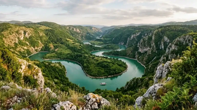
Valbona Valley Albania Hiking: Trails & Theth Pass (2026)

Quick Summary
Valbona Valley hiking at a glance
- Best Time to Go: Usually late June to September for the high pass, only when local trail and weather conditions allow; easier valley walks may be possible at other times.
- Top Trail: Valbona to Theth via Valbona Pass (Qafa e Valbonës).
- Difficulty: Moderate to strenuous, with steep, rocky sections and a long descent.
- Duration: Allow roughly 6–9 hours or longer, depending on the trailhead, pace and conditions.
- Important: The Blue Eye of Theth is a separate outing near Nderlysa, not a short detour on the pass crossing.
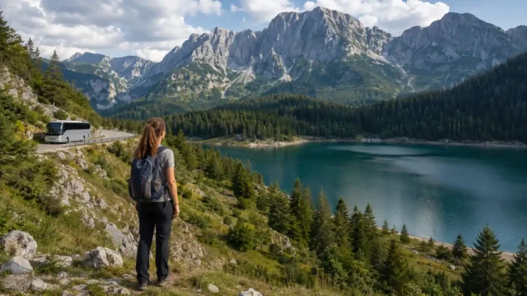
Valbona Valley Albania hiking is a memorable way to experience the Albanian Alps, also known as the Accursed Mountains. Limestone peaks, forested slopes and traditional guesthouses make the valley rewarding even if you do not cross the famous Valbona Pass. For many visitors, however, the highlight is the full-day walk from Valbona to Theth.
This guide explains the route, seasonal limitations, transport connections, other walks and the precautions that matter in steep mountain terrain. It also corrects a common itinerary mistake: the Blue Eye of Theth is not on the Valbona–Theth crossing. Allow a separate half-day or full day for that attraction rather than adding it to an already long mountain hike.
Table of Contents
Why Choose Valbona Valley for Hiking?
Valbona sits in the Albanian Alps (Bjeshkët e Namuna or Bjeshkët e Nemuna), a landscape of limestone peaks, beech woods and mountain streams. You may still see the name Valbona Valley National Park on older maps and signs. In 2022, the former Valbona Valley and Theth national parks, together with the Gashi River reserve, were incorporated into Albanian Alps National Park (Alpet e Shqipërisë).
The attraction is the combination of dramatic walking terrain and village life. Family-run guesthouses provide meals and local advice, but services are spread out and seasonal. Choosing a route that suits your fitness and checking current conditions with a host or licensed local guide are more important here than following a fixed itinerary found online.
🧐 Did You Know?
The name “Bjeshkët e Nemuna” is commonly translated as “The Accursed Mountains.” The region stretches beyond Albania into neighbouring Montenegro and Kosovo. Several long-distance routes cross international borders and require different planning from a simple Valbona–Theth day hike.
Which Valbona Hiking Trail Should You Choose?
The best Valbona hike depends on the time you have, your previous mountain experience and whether you want to finish in Theth. These are route-planning categories, not trail-opening guarantees: a short local walk may be possible when a snowy high pass is not.
| Trail or outing | Typical commitment | Suitable for | What to check |
|---|---|---|---|
| Valbona river and lower-valley walks | Flexible walk; turn back whenever convenient | Families and visitors wanting scenery without a full pass crossing | Riverbed conditions, footpaths near accommodation and weather |
| Kukaj village and viewpoints | Half-day or longer; one ~9–10 km loop takes about 3–5 hours | Walkers comfortable with steady uphill sections | Your actual start, route variant and elevation gain |
| Valbona → Theth via the pass | Full day, roughly 15–20 km with variable approaches | Fit hikers prepared for a long mountain crossing | Snow, storms, trailhead, luggage and the destination guesthouse |
| Maja Jezercë | Demanding alpine summit objective, not a casual add-on | Experienced mountain hikers, preferably with qualified local support | Technical terrain, route choice, weather and appropriate equipment |
If your group wants an easier outing, a valley walk or a carefully chosen Kukaj route is usually a better fit than trying to shorten the Valbona Pass crossing. For the wider Accursed Mountains and multi-country treks, see our Prokletije hiking guide for Albania and Kosovo.
Best Time for Valbona Valley Albania Hiking
A calendar month is not proof that a mountain route is passable. Snow can linger on high and shaded sections, while thunderstorms, heavy rain, strong wind or poor visibility can make a normally popular trail unsafe. Check the current route condition with your accommodation or a local mountain guide shortly before departure, then reassess on the morning of the hike. Albania’s National Agency of Protected Areas reported snow and avalanche-prone sections on the Theth–Valbona trail in May 2026; that illustrates why the actual trail status matters more than the month. See the agency’s 2026 public responses (entry dated 19 May).
- May–June: Excellent for scenery and some low-level valley walks, but Valbona Pass and other high routes may still have significant snow or ice. Do not assume the crossing is available just because the valley is accessible.
- July–August: The main hiking season, when the Valbona–Theth trail is often snow-free. Not all trails are automatically accessible. Heat, sudden storms, residual snow on higher or shaded routes, rockfall and temporary restrictions can still affect access. Reserve guesthouses in advance.
- September–October: September can offer cooler conditions, but days shorten and nights become colder. By October, snow, frost and seasonal service closures are increasingly possible; treat the high pass as condition-dependent, not a guaranteed autumn walk.
- November–April: High-level hiking can involve serious winter-mountain hazards, including avalanche terrain, ice and difficult navigation. The classic pass crossing is not a routine tourist hike in winter. Consider lower-altitude options only with up-to-date local advice.
How to Get to Valbona Valley
A popular way to reach Valbona from Shkodra combines a road transfer, the ferry across Lake Koman and a final transfer from Fierza. These services should be booked or reconfirmed together because schedules and connections vary with season and weather. Valbona can also be reached by road via Bajram Curri, which may be relevant if the ferry is not operating.
Step 1: Get to Shkodra
Shkodra (Shkodër) is the usual staging point for the ferry-and-hike itinerary. Buses and minibuses connect it with Tirana; allow roughly 2–3 hours or more depending on traffic and the departure point. Confirm the latest bus terminal and timetable rather than assuming every service leaves from the same location. If you are spending a night here, our Shkodër sightseeing guide helps you make use of the stop before heading into the mountains.
Step 2: The Lake Koman Ferry
The transfer from Shkodra to the ferry terminal at Koman uses a winding mountain road. Allow around two hours by arranged vehicle, with extra time for road conditions and check-in. The crossing of Lake Koman to Fierza (Fierzë) typically takes around 2.5–3 hours, depending on the operator and conditions. Check an operator’s current Koman–Fierza schedule before booking onward transport; published departure times are not guarantees against disruption. For comparison, the Berisha ferry operator publishes passenger-only fares starting at €9 online (cash fare €10), but those are ferry-only reference prices, not an all-in Shkodër–Valbona transfer fare, and can change.
Step 3: Drive to Valbona
From the Fierza landing, continue towards Valbona by a pre-arranged minibus or other road transfer, often via Bajram Curri. Allow around 1–2 hours for the final leg and connection, depending on your guesthouse location, vehicle and waiting time. Do not assume an unbooked vehicle will be waiting at the dock; reconfirm the final leg and tell the driver the exact name of your accommodation.
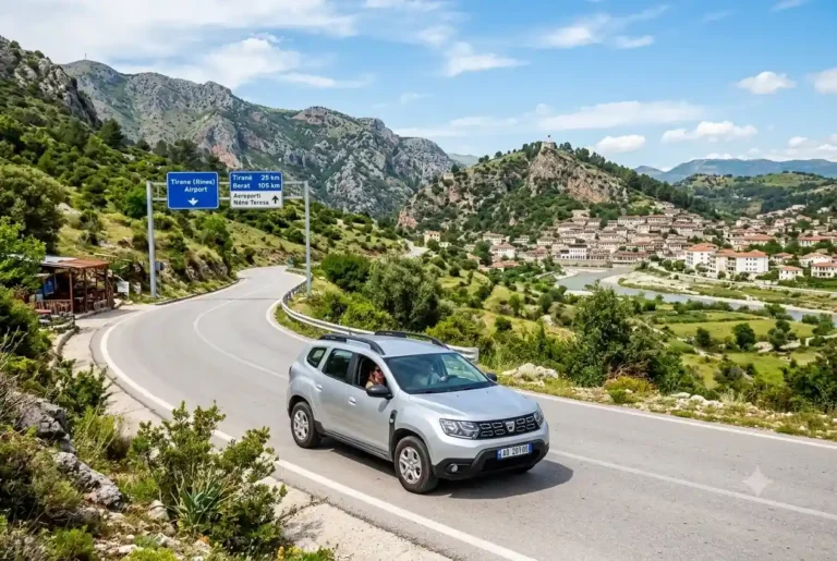
For the popular ferry route, the journey typically involves Tirana or Tirana Airport to Shkodra, a vehicle to Koman, the ferry to Fierza, and a final transfer to Valbona. A pre-booked airport transfer can simplify the first leg. Confirm its pick-up details and the next day’s ferry timing before committing. Book a Tirana Airport to Shkodra transfer on Kiwitaxi
From Shkodra, some operators bundle the road transfer, the Lake Koman ferry and the drop-off in Valbona. Check the date, exact meeting point, ferry operating status and whether all legs are included. See the Shkodra to Valbona ferry transfer on GetYourGuide
Our Komani Lake ferry guide compares operators and explains the difference between a passenger ticket and a full Shkodër–Fierza–Valbona transfer. If you book each leg separately, confirm that the final transfer will meet the ferry you choose.
The Crown Jewel: Valbona to Theth Hiking Trail
The Valbona–Theth crossing via Valbona Pass (Qafa e Valbonës) is the best-known long day walk in the Albanian Alps. It links two valleys across mountainous terrain rather than following a road. It is rewarding in suitable conditions, but should not be treated as a casual walk, especially if your experience is limited to flat trails.
Trail Overview
- Distance: Commonly around 15–20 km, depending on accommodation, actual trailhead and GPS route.
- Duration: Budget roughly 6–9 hours of walking, plus stops; slower hikers or longer approaches may need more time.
- Elevation Gain: Substantial ascent, often around 800–1,000+ m depending on where you start; check the elevation profile for your actual route.
- Highest Point: Valbona Pass (Qafa e Valbonës) at 1,795 meters.
- Difficulty: Moderate to strenuous. Fitness, sure footing and good weather are important; wet rocks, snow or poor visibility can greatly increase difficulty.
Valbona to Theth vs Theth to Valbona: Which Direction?
From the Valbona side, the ascent to the pass is generally shorter because the valley is higher; common profiles suggest approximately 800 m of climbing from typical Valbona-side starts. Theth begins lower, so the ascent when hiking in reverse can reach roughly 1,000 m or more. These are not fixed values: your guesthouse or transfer drop-off changes the profile.
The Valbona → Theth direction still ends with a long, sometimes slippery descent. Walk Theth → Valbona instead if the direction fits your onward transport or if you prefer climbing the steeper side rather than descending it. Do not pick a direction based on an elevation number alone; check the actual GPX, conditions and your accommodation plans.
This is a point-to-point hike, not a loop. Book a night in the finishing village, ask where the trail actually ends relative to that property, and arrange luggage transfer or storage in advance. Do not carry a full travel suitcase over the pass. Confirm the cost and operator; a guesthouse may be able to coordinate transfers without automatically including them in the room rate.
The Route Description
1. The Start (Rrogam)
Your walking distance depends on the location of your Valbona guesthouse. Many hikers head up the valley toward Rrogam (Rragam), where the approach gives way to steeper trail sections. Some arrange a local 4×4 as far as the vehicle-accessible approach permits, which can reduce the road walk. Confirm the actual drop-off point with your host; the track condition and service are not guaranteed.
💡 Pro Tip: The 4×4 Transfer
Ask your guesthouse whether a 4×4 transfer toward Rrogam is running, how far it goes and what the current fare is. A shorter approach may help if you have a long day ahead, but never plan your hiking time around an unconfirmed ride.
2. The Ascent
Beyond the Rrogam area, the climb becomes steeper, climbing through woodland and more exposed mountain terrain. Red-and-white trail markings appear along the commonly walked route, but may be hidden or difficult to follow in snow, fog or storm damage. Use an offline topographic map and track your progress; do not rely on signs alone.
3. Valbona Pass (Qafa e Valbonës)
Valbona Pass is approximately 1,795 metres above sea level, with expansive views towards the surrounding limestone peaks in clear weather. Stop only where the ground is stable and keep away from exposed edges. Small seasonal cafés may operate on parts of the route, but opening hours and supplies cannot be relied upon. Carry the food and water you need to complete the entire crossing.
⚠️ Weather Warning
Storms and reduced visibility can develop quickly near the pass, including in summer. Start early enough to allow ample daylight, but an early start does not make an unsafe forecast safe. If lightning, strong wind, heavy rain or snow is expected, postpone the crossing. Never continue onto an exposed ridge during a thunderstorm.
4. The Descent to Theth
After the pass, the route descends towards Theth through a mixture of rocky slopes, switchbacks and wooded sections. Loose stones and wet ground can make the descent demanding on your knees and ankles. Follow the signed main route to the village, staying alert at junctions and checking your offline map. Do not look for the Blue Eye of Theth as a 20-minute detour here: it is a different excursion, farther down the Theth valley near Nderlysa.
Blue Eye of Theth: Plan It as a Separate Trip
The Blue Eye of Theth (Syri i Kaltër i Thethit, also called the Blue Eye of Kaprre) is a spring pool near Nderlysa (Ndërlysaj), downstream from Theth village. It is not beside the Valbona Pass trail and it is not a 20-minute detour on the descent.
- From Theth by vehicle: Travel roughly 7–8 km towards Nderlysa, subject to road and transport conditions. From the trailhead, walk approximately 2–3 km each way on an uneven, sometimes steep path.
- Walking time from Nderlysa: Allow around 40–60 minutes in each direction, plus time at the pool and margin for slower sections. Together with transport, this is normally a half-day outing.
- Starting entirely on foot in Theth: This becomes a much longer outing, potentially taking most of the day. Check the exact route and avoid combining it with the pass crossing.
- Safety: The rocky approach may be wet and slippery; the water is extremely cold and is not a safe swimming assumption. Stay well back from slippery edges.
For route descriptions and current visitor context, see this Blue Eye of Theth access guide or our Theth hiking guide. Double-check the route locally before going because paths and transport arrangements can change.
A More Realistic 3–4-Day Valbona and Theth Plan
- Day 1: Travel from Shkodra to Valbona using the booked ferry-and-transfer connection (or confirmed road alternative). Stay overnight in Valbona.
- Day 2: Cross Valbona Pass to Theth only if conditions are suitable. Allow the full day and sleep in Theth.
- Day 3: If you want to visit the Blue Eye, arrange a separate Nderlysa trip. Stay another night in Theth if needed for comfortable transport and recovery.
- Day 4 (if needed): Return to Shkodra by pre-arranged transport. Add a flexible weather day if the pass crossing is central to your trip.
What If the Valbona Pass Is Not Safe on Your Date?
Do not try to cross a snow-covered or storm-exposed pass to keep an onward hotel booking. Instead, spend another night in Valbona and ask locally about a low-level walk suitable for the weather, or arrange a road transfer via Bajram Curri and Shkodër if you must reach Theth. There is no short direct road between the valleys. The driving alternative is a much longer journey and may need a separate day.
When planning a multi-day trip, avoid buying tightly timed onward transport immediately after the crossing. Leaving one flexible night makes it easier to respond to a poor forecast without taking avoidable risks.
Other Hiking Routes in Valbona
You can enjoy Valbona without attempting the high pass. These alternatives vary considerably in length and difficulty, and high-altitude routes may remain unsafe even when village walks are straightforward.
1. Hike to Kukaj
Kukaj is a mountain settlement reached by routes that climb above Valbona. It is a worthwhile half-day option, but it should not automatically be described as a two-hour stroll: some commonly used loops are roughly 9–10 km and take around 3–5 hours, with meaningful ascent. Exact times depend on your guesthouse and chosen track. Ask locally which route is open and suitable for your group.
2. Jezerca Peak
At approximately 2,694 m, Maja Jezercë is the highest summit in the Albanian Alps. Reaching it involves a demanding mountain route with significant elevation, navigation challenges and possible lingering snow or ice. It is not an extension of an easy valley walk. Hire an experienced local mountain guide if you lack relevant alpine experience, and decide on gear, route and whether to attempt it only after checking current conditions. For advanced summit and cross-border context, see the broader Prokletije hiking guide.
3. Rrogam Waterfall and the Upper Valley
The waterfall above the Rrogam area is an alternative outing for visitors staying in Valbona. Its flow varies with snowmelt and the season, and the approach may be muddy or uneven. Ask your host about current water levels and the recommended path. Do not assume conditions are suitable for swimming: cold water, slippery rock and changing stream levels can be hazardous.
Preparation and Packing List
For Valbona Valley Albania hiking, route preparation should be as thorough as packing. Download an offline map with the actual trail and altitude profile, check your phone battery, tell your accommodation where you are going and decide in advance when you will turn back if progress is too slow or conditions worsen.
Essential Gear
- Footwear: Broken-in hiking footwear with reliable grip; loose limestone and wet stones demand careful footing.
- Backpack: A comfortable day pack large enough for water, food, weather layers and essentials; if carrying overnight gear, adjust the size to your needs.
- Waterproof Jacket: Weather changes rapidly in the mountains.
- Layers: Bring a fleece or light down jacket. It can be cold at the pass even if it is hot in the valley.
- Sun Protection: Hat, sunglasses and sunscreen; many upper sections are exposed.
- Navigation and emergency kit: Offline topographic route, power bank, headtorch, basic first-aid supplies and any essential personal medication.
Food and Water
Plan your water according to heat, route length and personal needs. For a full-day crossing, 2–3 litres per person is a useful starting point for many hikers, and you may need more in hot conditions. Do not rely on natural springs, seasonal cafés or a specific refilling point being available; carry a filter or suitable treatment if you intend to use untreated water. Bring lunch and energy-dense snacks as well.
💧 Water Refill Hack
Do not carry only one litre on the assumption that springs will be flowing. Sources can be seasonal, inaccessible or contaminated despite clear-looking water. Start with enough drinking water for your planned day, use appropriate treatment for any refills and seek local advice about currently reliable sources.
Where to Stay in Valbona
Valbona has family-run guesthouses, small lodges and other seasonal accommodation. Choose the location carefully: guesthouses can be several kilometres apart, affecting where your hiking day actually begins.
Guesthouses (Hanet)
Guesthouses are often the easiest way to arrange dinner, a packed lunch and up-to-date information on transport and trails. Rooms and bathrooms vary, so check what is included before booking. Traditional dishes may include flija, cheeses, local vegetables and meat dishes; confirm dietary requirements ahead of time. Also ask your host whether baggage storage or transfer is possible if you plan to cross to Theth.
Camping
If you intend to camp, check the site with the protected-area administration rather than assuming an informal arrangement is sufficient. Albania’s protected-areas agency clarified in August 2026 that camping inside protected areas is restricted to designated camping zones, with applicable conditions and fees. See the agency’s published response of 4 August 2026. The exposed pass is not a sensible casual overnight option, particularly if thunderstorms, wind or cold weather are possible.
Guesthouses can fill quickly during busy weeks. Compare locations as well as room prices: a cheaper room much farther down the valley can add walking distance or transfer costs to your pass-crossing day. Compare Valbonë stays on Agoda
Practical Tips for a Smooth Hike
The most useful safety precautions are simple: verify the trail condition locally, keep a realistic time budget, use reliable navigation, carry sufficient water and have a plan if you must turn back.
Cash is King
Do not depend on finding a working ATM or being able to pay by card in Valbona or Theth. Bring enough Albanian lek (ALL) in advance for guesthouses, meals, taxis and unexpected changes; check individual accommodation payment options when you book.
Confirm both valley guesthouse bookings, your Koman ferry/road transfers, the current pass condition, offline navigation and enough Albanian lek for meals, transport changes and a weather-delay night.
Internet and SIM Cards
Mobile coverage can be patchy in the Albanian Alps, regardless of your provider. If you need local service, compare available SIM or eSIM options before leaving a larger town, then download navigation maps and transport details for offline use. Do not treat a mobile signal as your only emergency plan.
Navigation
The popular Valbona–Theth route is marked in normal clear-season conditions, but snow, landslides, fog or fallen trees can obscure a junction. Download a topographic map and a current GPX track from a reputable route provider, and bring a charged phone and power bank. Do not follow a digital line into hazardous terrain if it conflicts with actual conditions. In an emergency, Albania’s general emergency number is 112, but coverage may be unavailable in remote sections.
The hike is remote and physically demanding, and not all travel-insurance policies include hiking or mountain rescue. Before buying, check altitude limits, trekking exclusions, evacuation provisions and the terms that apply to your chosen route. Compare travel insurance plans on VisitorsCoverage
Valbona Hiking Budget: What to Price Before You Leave
The same trail can cost very different amounts depending on whether you use shared transport or private vehicles, stay in basic guesthouses or upgraded lodges, and need a guide. Instead of a misleading fixed daily budget, prepare a per-person checklist for the exact dates and whether costs are split across your group.
| Budget item | What to ask | Often overlooked |
|---|---|---|
| Shkodër → Valbona | Full van–ferry–van price or separate legs? | Ferry ticket alone does not include road transfers |
| Two guesthouse nights | Is breakfast, dinner or a packed lunch included? | Night in Valbona and night in Theth are different bookings |
| Trailhead and luggage | Is Rrogam transport or bag transfer offered? | Pickup may not reach your actual accommodation |
| Optional guide | Half-day vs full-day; group size; cancellation policy | Guide does not make unsafe snow/storm conditions safe |
| Weather buffer | Extra room and food in either valley | Missed ferry, delayed crossing or a replacement road transfer |
Check the Koman ferry guide for published ferry examples, then ask guesthouses about the full price of connecting vans and bags. Calculate per-person cost only after separating shared vehicle charges from individual tickets.
Independent Hiking vs. Guided Tours
| Feature | Independent Hiking | Guided Tour |
|---|---|---|
| Cost | Often lower upfront, but self-organised transport | Usually higher; inclusions vary |
| Flexibility | Flexible within weather and daylight limits | Arranged schedule; should adapt to unsafe conditions |
| Safety | You assess conditions and manage decisions | Guide supports risk decisions and response; cannot guarantee safety |
| Local Knowledge | You must verify route, weather and connections | Route knowledge and local advice vary by operator |
| Best For | Experienced, well-prepared hikers in suitable conditions | Those who prefer organised support; still assess fitness |
Frequently Asked Questions
Is the Valbona to Theth hike safe in July or August?
It is commonly hiked in summer, but no month guarantees safe conditions. Confirm local trail status and weather before departure, avoid thunderstorms or snow beyond your experience, and be prepared to postpone.
Is the Blue Eye of Theth on the Valbona Pass hiking route?
No. The Blue Eye of Theth is near Nderlysa, down the valley from Theth. Plan it as a separate half-day trip with transport to Nderlysa and an additional walk, or allow most of a day if walking all the way from Theth.
Do I need a guide for hiking in Valbona?
Experienced hikers may cross the normally marked Valbona–Theth trail independently when conditions are good. A qualified local guide is a sensible option if you are unsure about route finding, mountain weather or your experience. More demanding routes such as Jezerca require specialist judgement.
Can I hike Valbona alone?
Solo hiking is possible but increases the consequences of an injury or route problem. Share your plan and expected arrival, carry offline navigation and emergency supplies, and avoid going alone when conditions are uncertain.
How difficult is Valbona Pass?
Treat it as a moderate-to-strenuous full-day mountain hike with sustained climbing, steep rocky descent and limited escape options. Times vary with the starting point, weather and hiking ability.
When is the high pass usually accessible?
The most common window is approximately late June through September, but lingering snow, early autumn storms or other hazards can make a route unsuitable outside or even inside those dates. Seek a current local assessment before committing.
Planning Resources and Important Safety Notes
This article is a planning guide, not a live bulletin on trail openings or weather. For protected-area context, consult the Albanian National Agency of Protected Areas. Confirm ferry dates with your chosen operator and ask a local guide or guesthouse about the specific trail on the day before you hike. If a warning conflicts with an online itinerary, follow the current safety advice rather than the itinerary.
Conclusion: Embrace the Adventure
Valbona Valley Albania hiking combines dramatic scenery, mountain hospitality and the chance to travel between two memorable valleys. The Koman ferry journey and a safe crossing of Valbona Pass can make an outstanding itinerary, but only when season, weather, fitness and logistics align.
Take the pass seriously, confirm trail access on the ground, and give the Blue Eye of Theth its own time rather than squeezing it into a long hiking day. If conditions are unsuitable for the crossing, a shorter valley walk and an extra night can be the better decision. A flexible plan makes these mountains more enjoyable and considerably safer.
Ready to Plan Your Trip?
Once you have checked your season and allowed enough days for possible weather delays, compare flights to Tirana and review the ferry, transport and accommodation details before confirming your route.