Prokletije Hiking in Albania & Kosovo: Trails, Permits & Safety (2026)

Prokletije Hiking in Albania & Kosovo offers everything from accessible valley walks and the famous Theth–Valbona crossing to demanding summit routes and the multi-day Peaks of the Balkans trail. This updated guide explains which hikes suit different experience levels, when to go, how border permits work, and what to know about transport, rescue, camping and mountain safety.
⚡ Prokletije Hiking in Albania & Kosovo: Quick Answer
- Where are the Prokletije? Across northern Albania, western Kosovo and southeastern Montenegro.
- Best-known day crossing: Theth–Valbona in Albania.
- Highest peak of the Albanian Alps: Maja Jezercë, 2,694 m. It is not Albania’s highest mountain; Mount Korab is higher.
- Highest peak in Kosovo: Gjeravica, 2,656 m.
- Best-known multi-day route: Peaks of the Balkans, about 192 km on the classic circuit; some variants are shorter.
- Best high-mountain planning window: Usually June to September, but current snow and weather conditions matter more than the calendar.
- Cross-border hiking: Remote mountain crossings require advance legal arrangements; a marked trail is not itself a border permit.
- Best advice for first-time visitors: Choose an exact route and check its current condition rather than treating the whole range as one difficulty level.
That variety is exactly what makes the Accursed Mountains so appealing—and why route choice matters. A famous name on a hiking map does not tell you whether a trail is suitable for a beginner, whether snow remains on a pass, whether a border permit is required, or whether the final approach needs a 4×4 transfer.
This guide focuses on the practical decisions you need to make before hiking: which side of the range to use as your base, which routes match your experience, when to go, how border crossings work, what rescue and navigation support exists, where camping is allowed, and how to reach the trailheads without turning the transport into a bigger problem than the hike.
Table of Contents
What Are the Prokletije Mountains?
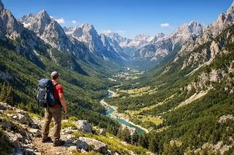
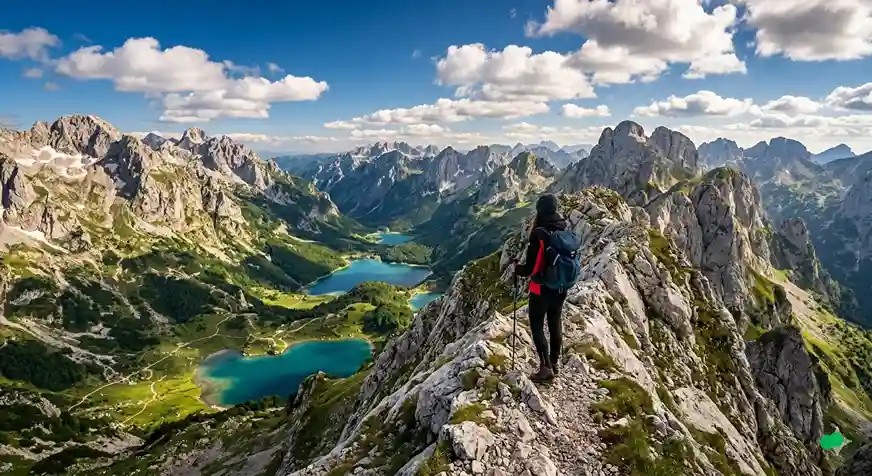
The Prokletije—known in English as the Accursed Mountains and in Albanian as Bjeshkët e Nemuna/Bjeshkët e Namuna—form the southern part of the Dinaric mountain system. The range extends across Albania, Kosovo and Montenegro and is characterized by sharp limestone peaks, glacial valleys, high meadows, forests and alpine lakes.
The Albanian side includes Theth, Valbona and other areas now grouped within the Albanian Alps National Park. The official Albanian tourism website describes the park as encompassing Theth, Valbona and Vermosh. On the Kosovo side, much of the mountain landscape lies within Bjeshkët e Nemuna National Park, with Peja, Rugova and Deçan acting as important access points.
Read the official Albanian Alps National Park overview.
The borderlands were heavily restricted and militarized during parts of the 20th century, particularly along the former Albania–Yugoslavia frontier. That history contributed to the isolation of many valleys and shepherd routes, but it is more accurate to describe the border areas as historically restricted than to say the entire Prokletije range was completely closed to the public for most of the century.
Albania or Kosovo: Which Side Should You Choose?
For a first trip, it is useful to choose a base according to the kind of hiking you want rather than simply choosing a country. A good Prokletije Hiking in Albania & Kosovo itinerary starts with the exact route and trailhead, then builds transport and accommodation around it.
| Base | Best For | Typical First Routes | Main Planning Issue |
|---|---|---|---|
| Theth | Classic Albanian Alps scenery and access to the Valbona Pass | Local valley walks, Blue Eye area, Theth–Valbona | Point-to-point transport if continuing to Valbona |
| Valbona | Valley scenery and access to the Valbona Pass from the higher side | Valley walks, Valbona–Theth crossing | Longer access logistics, often via Fierza/Koman |
| Peja / Rugova | Flexible Kosovo day hiking with a city base | Rugova walks, Liqenat/Kuqishtë-area hikes, guided mountain days | Trailhead transport and choosing the correct route variant |
| Junik / Deçan area | Access toward Gjeravica and remote highland terrain | Gjeravica routes | Road condition, 4×4 access and route-specific logistics |
Trail Comparison: Do Not Treat Every Famous Route as the Same Difficulty
Published distances and elevation figures vary depending on the exact trailhead, GPS track and route variant. The table below is therefore a planning comparison rather than a substitute for the current GPX file you will actually use.
| Route | Country | Typical Scale | Who It Suits |
|---|---|---|---|
| Theth–Valbona | Albania | About 15–18 km, usually 6–8 hours depending on endpoints | Fit beginners who have already done long hilly walks |
| Maja Jezercë | Albania | Long alpine summit day; exact route varies | Experienced hikers comfortable with steep alpine terrain and scrambling |
| Gjeravica from Dobërdol to Gacaferi | Albania/Kosovo | About 19 km, +1,134 m, 8–9 hours on the published route | Strong hikers; cross-border paperwork required for this variant |
| Rugova / Liqenat-area hikes | Kosovo | Varies by exact route; many are substantial mountain walks | Good progression from easier valley hiking to bigger mountain days |
| Peaks of the Balkans | Albania/Kosovo/Montenegro | Classic circuit: about 192 km / 10–12 days; variants differ | Hikers with multi-day trekking fitness and logistics experience |
Theth–Valbona: The Classic Albanian Alps Crossing
The Theth–Valbona crossing is the best-known point-to-point hike in the Albanian Alps. It crosses the Valbona Pass at roughly 1,795–1,800 m and links two mountain valleys that are otherwise separated by a long road journey.
Different sources and GPS tracks publish distances between roughly 15 and 18 km, depending on the precise start and finish points. A realistic planning estimate is 6–8 hours of walking for a fit hiker in good conditions; allow a longer full-day window for rest breaks, photos, heat, rough footing or trail congestion.
Which Direction Is Easier?
The trail can be walked in either direction. The old advice that Theth → Valbona is automatically easier because the ascent is more gradual is misleading. Theth sits lower, so hiking toward the pass from Theth involves roughly 1,000–1,050 m of climbing on commonly published profiles. The Valbona side begins higher, and commonly published tracks show less ascent to the pass, although the figure depends on how far up the valley your walk begins.
That does not make Valbona → Theth the correct direction for everyone. A long descent can be hard on knees, the sunny side can feel very different in summer heat, and your transport plan may matter more than a few hundred meters of climbing. Choose the direction that fits your itinerary and fitness rather than following a universal “best direction” rule.
💡 First-Timer Tip
Theth–Valbona is not a casual village stroll. If you have never completed a long hike with sustained climbing and descending, do a shorter hilly route first. On the crossing itself, start early, carry water and layers, and confirm snow and storm conditions with your accommodation before leaving.
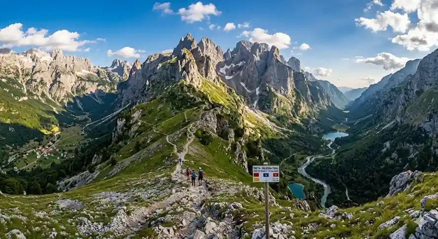
For current local planning information, the important variables are not only distance and time but whether the pass is clear of snow, whether seasonal refreshment huts are operating, and how you will move your main luggage between valleys. Do not treat the Blue Eye of Theth as a short detour from the pass crossing: the usual Blue Eye approach is a separate excursion from the Nderlysa area and needs its own time and transport plan.
For trailhead photographs, map context and route variations, read our Theth hiking guide and the separate Valbona Valley hiking guide. Use those for local hiking detail; use this guide for deciding between Albania, Kosovo and the multi-country trek.
Maja Jezercë: Highest Peak of the Albanian Alps, Not of Albania
Maja Jezercë rises to 2,694 m and is the highest peak in the Albanian Alps. However, it is not the highest mountain in Albania. Mount Korab, on the Albania–North Macedonia border, reaches 2,764 m and is the country’s highest peak.
The official Albanian tourism information describes Jezercë as an objective for alpine climbing and advanced hiking and emphasizes the steep terrain. That is a much better way to frame the mountain than presenting it as the next logical step after Theth–Valbona.
Read the official tourism information for Maja Jezercë.
⚠️ Who Should Attempt Jezercë?
Treat Jezercë as an advanced mountain objective. Route-finding, steep rock, exposure, scrambling, snow patches and changing weather can all matter depending on the route and season. If you are not already comfortable in this kind of terrain, use a qualified local guide or choose a lower mountain day instead.
Gjeravica: Kosovo’s Highest Peak
Gjeravica reaches 2,656 m and is Kosovo’s highest peak. The mountain can be approached from more than one direction, so a single “Gjeravica distance” is not useful unless you also name the trailhead and route.
One clearly documented option is the Peaks of the Balkans variant from Dobërdol → Gjeravica → Gacaferi. The published Dobërdol–Gjeravica–Gacaferi Pastures stage is about 19 km with approximately 1,134 m of ascent and an estimated 8–9 hours. Those figures describe that particular cross-border stage, not a standard out-and-back climb from Kosovo. Because it crosses from Albania into Kosovo away from a standard road checkpoint, it also involves cross-border authorization.
See the published Dobërdol–Gjeravica–Gacaferi route and GPX information.
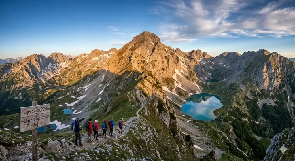
There are also routes from the Kosovo side, including approaches associated with Junik and the Gropa e Erenikut area. Road access and the exact hiking distance can differ significantly, so confirm the current trailhead before setting out. Do not combine the statistics of one approach with the map of another.
Rugova and Liqenat: A Better Progression for Many Visitors
If you want to experience the Kosovo side without immediately committing to Gjeravica, the Rugova area is a more flexible base. Peja gives you accommodation, restaurants and road access before you move into the mountains, while the Rugova valley provides a range of walks that can be chosen according to weather and fitness.
Do not automatically label every lake route “easy.” For example, the wider Peaks of the Balkans network lists a Liqenat i Kuqishtës/Guri i Kuq stage of more than 15 km with substantial climbing. Shorter local variants exist, but the exact route matters. For beginners, ask a local accommodation provider or guide for the specific trail and current conditions rather than relying on the lake name alone.
If Peja will be your base, use our Peja and Rugova planning guide for the city, canyon and transport context. Pick a specific Liqenat or Rugova trail separately before arranging a driver.
Peaks of the Balkans: A Multi-Day Trek, Not a Beginner Shortcut
The Peaks of the Balkans is the signature long-distance trek of the region. The classic, ten-stage circuit is approximately 192 km and is commonly organized over roughly 10–12 days through Albania, Kosovo and Montenegro. Shorter modern itineraries and rerouted stages exist, so verify the total distance against the exact GPX track and stages supplied by your organizer.
A published ten-stage itinerary lists roughly 9,800 m of ascent and describes its route as technically moderate overall but demanding in fitness and sure-footedness. Other itineraries publish different totals because their stage choices are not identical. That distinction is important. A trail can avoid technical climbing and still be a poor choice for someone’s first multi-day mountain trip.
Review the current Peaks of the Balkans stages and route statistics.
Who Is the Full Circuit For?
You should already know how your body handles consecutive hiking days, significant cumulative climbing, variable waymarking, remote accommodation and changing weather. If that sounds like too large a first step, hike one or two individual sections instead.
Cross-Border Permits: Do Not Improvise at Mountain Borders
One of the attractions of the Peaks of the Balkans is walking between countries through high mountain terrain rather than using ordinary road crossings. Legally, however, a trail line on a map is not permission to cross an international border wherever you want.
Montenegro’s official tourism information states that hikers crossing outside official border checkpoints in areas such as Prokletije must follow the legal procedure and submit a request to the relevant border police. The exact process can depend on the country, route and current rules.
Check Montenegro’s official border-crossing guidance.
For multi-country trekking, arrange the paperwork before you enter the mountains and carry your passport plus any authorization required for the crossing. Avoid copying an old application deadline or fee from a blog and assuming it remains valid.
Cross-border permit checklist
- List every planned border crossing, including the direction and approximate date.
- Ask the relevant border police or experienced licensed operator which application and identity documents are required for your nationality and route.
- Apply well in advance; the route operator recommends allowing roughly four weeks, but this is planning guidance, not a universally guaranteed legal deadline.
- Receive approval before setting off, and carry your passport and the permit in an accessible format.
- If you change stages or dates, ask whether the authorization must be amended. Never assume an informal shortcut is covered.
Official reference: Montenegro National Tourism Organisation — crossing outside checkpoints.
When to Hike Prokletije
For high passes and long mountain stages, June to September is the usual planning window, but there is no date on which every route becomes automatically safe. Late snow can remain on higher terrain, while storms, heat and early autumn cold can change conditions quickly.
| Period | Typical Planning Consideration |
|---|---|
| May–early June | Valley walks may be possible, but snow can remain on passes and summit routes. |
| Mid-June–August | Main trekking season; long daylight, operating guesthouses, but heat and afternoon storms still matter. |
| September | Often excellent hiking weather, but never assume every high trail is “fully clear” without checking current conditions. |
| October | Lower routes can still work in a good year; high passes may see snow, ice and reduced services. |
| Winter/early spring | Winter mountaineering conditions; not ordinary hiking season. |
Before a major route, check three things: current snow/trail conditions, the mountain weather forecast, and local information from your guesthouse, guide or park contact. A GPX track cannot tell you whether a pass is icy today.
Navigation: Download the Route Before You Leave
Popular routes can be straightforward to follow in good conditions, but the Prokletije should not be treated as a place where phone signal and trail signs will solve every problem. Markings can vary, fog can remove visual landmarks and remote paths may have junctions that are obvious only if you already know the route.
Download the current GPX and offline map before leaving your accommodation. Carry enough battery capacity for a full day, know how to read your position without mobile data, and keep a backup navigation option for remote routes.
The Peaks of the Balkans map information itself notes that waymarking is generally present but not always clearly visible, which is a useful mindset for the entire region: signs are support, not a replacement for navigation.
Mountain Rescue and Emergency Planning
The old claim that there are “no official mountain rescue services in Albania or Kosovo” is inaccurate and should not be repeated.
In Kosovo, the Kosovo Mountain Search and Rescue Service operates mountain rescue teams, including a documented station in Peja and another in Deçan. Check its official contact information before traveling; do not rely on a single unverified number copied into a blog. In Albania, emergency response can involve State Police, civil-emergency services and other specialist units; Albania’s emergency number 112 can be used to request urgent help. Save the relevant local mountain-rescue contact before traveling as a supplement, not a replacement for emergency services.
Check the current Kosovo Mountain Search and Rescue contact information.
🚨 Rescue Is Not a Substitute for Conservative Planning
Remote terrain can make response slower or more complicated than in a city. Share your route with someone, carry enough clothing and food to cope with an unexpected delay, and turn around before a small navigation or weather problem becomes an emergency.
Before your hike: share the intended GPX and return deadline with your guesthouse or another reliable contact. In an emergency, give responders your coordinates, nearest identifiable waypoint, number of people and any injuries. Mobile reception cannot be assumed in deep valleys; consider a satellite communication device for remote multi-day routes.
Camping Rules: Do Not Assume Wild Camping Is Automatically Allowed
Camping rules depend on the country and protected area. On the Albanian side, this matters because Theth and Valbona are within protected landscapes administered under the Albanian protected-areas system.
In an official 2026 response, Albania’s National Agency of Protected Areas stated that camping inside protected areas is permitted only in specifically designated camping zones and is subject to applicable rules and fees. That makes the broad statement “camping is permitted in many parts of Prokletije” too loose for a planning guide.
See the 2026 protected-area guidance from Albania’s NAPA.
If camping is part of your itinerary, check the exact protected area and intended campsite rather than relying on reports from another valley or another country.
How to Get to the Albanian Side
Shkodër is the usual staging city for Theth and many northern Albania itineraries. Theth is now reachable by road, while Valbona is often combined with the Koman/Fierza corridor or approached by road from the northeast depending on the wider itinerary.
The exact minibus schedules are seasonal and can change. Instead of building your hike around an old departure time copied from a blog, confirm the current transfer with your accommodation or transport provider shortly before travel.
Affiliate disclosure: Some booking links below are affiliate links. If you book through them, Balkan Trip Guide may earn a commission at no additional cost to you. They are included only where they match a practical planning need.
If you are flying into Albania, you can compare flights to Tirana on Trip.com. Check the baggage rules and connection times, especially when combining an international flight with onward travel to Shkodër.
If you prefer a pre-arranged road connection before continuing into the mountains, you can check Tirana–Shkodër transfers with Kiwitaxi. Compare the full transfer cost with buses or shared transport before booking.
How to Reach the Kosovo Side
For Rugova and many western Kosovo routes, Peja is the most practical city base. It gives you easier access to accommodation and transport while still placing you close to mountain trailheads.
For Gjeravica, the important question is not simply “How do I get to Gjeravica?” but which approach are you hiking? Routes associated with Junik, Gropa e Erenikut, Deçan or the cross-border Dobërdol/Gacaferi network require different access plans. Some final road sections may require a suitable vehicle or a local driver.
Two Short Prokletije Itineraries You Can Actually Plan
These are sample frameworks, not guaranteed transport timetables. They deliberately avoid squeezing the Theth–Valbona crossing, an international mountain transfer and a summit into the same day.
Four Days in the Albanian Alps (Theth to Valbona)
- Day 1 — Shkodër to Theth: travel to Theth, check into a guesthouse and take a short valley walk if arrival and weather allow.
- Day 2 — Theth: choose a suitable valley excursion or plan the Blue Eye separately via Nderlysa; do not add a major summit.
- Day 3 — Theth to Valbona on foot: allow a full hiking day, confirm conditions and arrange baggage delivery if needed. Sleep in Valbona.
- Day 4 — Valbona onward: use your pre-arranged transfer, possibly involving the Fierza–Koman ferry corridor if seasonal services align. Confirm the entire chain before booking accommodation or flights.
Three Days Based in Peja, Kosovo
- Day 1 — Peja and lower Rugova: arrive, check the weather and use a short walk to understand local trail conditions.
- Day 2 — One selected Rugova or Liqenat route: arrange trailhead transport and pick a GPX that matches your fitness; carry a return plan.
- Day 3 — Recovery, another suitable walk or onward travel: use this as a weather buffer. Only experienced hikers with separately arranged access should substitute a major Gjeravica attempt.
Transport rule: never assume a road between valleys means a short transfer. Ask about the actual pickup point, vehicle type, luggage policy, border crossing and latest possible return time before paying a deposit.
Where to Stay
Theth and Valbona have developed a strong guesthouse culture, often with breakfast and dinner available. This is particularly useful for hikers because it reduces the amount of food you need to carry and makes it easier to ask about current trail and snow conditions.
For the Kosovo side, Peja provides the broadest range of city accommodation, while mountain guesthouses and seasonal stays become more relevant as you move toward Rugova, Deçan, Junik and the highland stages of the Peaks of the Balkans.
For Theth, you can compare guesthouses and accommodation on Agoda. Accommodation availability and meal plans vary by season. Check the property’s actual map location rather than assuming everything listed under “Theth” is equally close to your trail start.
Budget: Price the Trip by Category
Fixed daily budgets age quickly in the Prokletije because the cost difference between a simple guesthouse trek and a private guided summit day can be large. Instead of relying on one number, price the components of your exact itinerary.
- Accommodation: guesthouse, hotel or mountain stay; check whether breakfast and dinner are included.
- Food: half-board can simplify mountain days, while remote lunches and snacks may need to be carried.
- Trailhead transport: shared minibus, taxi, private transfer or 4×4 access.
- Luggage transfer: particularly relevant on point-to-point Albanian Alps itineraries.
- Guide: optional for many popular routes but valuable for advanced summits, poor navigation confidence or complex cross-border days.
- Border paperwork: ask what is included if booking a Peaks of the Balkans package.
- Insurance: check hiking, altitude, rescue and evacuation exclusions.
The expensive part of a mountain day is often not the walking. A private 4×4 trailhead transfer or complicated point-to-point connection can cost more than a night in a guesthouse, so solve the access problem before comparing room prices.
Guided vs Self-Guided Hiking
A guide is not necessary for every Prokletije route. Popular, well-traveled trails can be reasonable self-guided objectives for hikers who have navigation skills and current route information.
A guide becomes much more useful for Maja Jezercë, unfamiliar Gjeravica approaches, poor-weather decisions, complicated remote transfers, or any trip where the border and route logistics are part of the difficulty.
If you want to compare organized options in the Albanian Alps, you can browse Theth and Albanian Alps hiking experiences on GetYourGuide. Some experiences are transport tours rather than full hiking days. Read the actual hiking distance and difficulty of each product rather than assuming every “Theth tour” includes the Valbona Pass.
Travel Insurance: Read the Activity Exclusions
Insurance is most useful when you understand what it actually covers. Before buying, check the maximum hiking altitude, whether trekking is covered when unguided, whether mountain rescue or evacuation is included, and whether scrambling or mountaineering changes the activity category.
You can compare travel-insurance options through VisitorsCoverage. Check which policies include your intended altitude, unguided hiking, rescue and evacuation. Always read the policy wording for your nationality, destination and planned activities before purchasing.
Essential Gear for Prokletije Hiking
Your pack should match the exact route. A low valley walk from Theth is not the same equipment problem as an exposed summit day or a ten-day circuit.
🎒 Practical Packing Checklist
☑️ Broken-in hiking footwear
☑️ Rain and wind shell
☑️ Warm layer
☑️ Sun protection
☑️ Water capacity for the route
☑️ Offline map + current GPX
☑️ Power bank
☑️ First-aid and blister kit
☑️ Headlamp
☑️ Passport for border itineraries
☑️ Food plus emergency margin
☑️ Trekking poles if useful to you
Do not assume that every natural spring will be flowing or safe simply because it is marked on an old map. Ask locally about water on your exact route and carry enough capacity for the longest dry section.
Wildlife and Leave-No-Trace Planning
The wider Prokletije landscape supports chamois, birds of prey and large mammals including brown bears and wolves. Wildlife encounters are generally not the main risk for hikers, but the mountains deserve normal backcountry discipline: keep food controlled, avoid approaching animals, do not leave rubbish, and do not disturb livestock or shepherd dogs.
Stay on established routes where possible, particularly in sensitive protected areas. The most useful principle is simple: your visit should leave the trail, campsite and mountain village in the same condition—or better—than you found it.
A Simple First-Trip Plan
If this is your first visit to the Accursed Mountains, you do not need to combine every famous route into one trip. A more realistic progression is:
- Choose one main base: Theth/Valbona for Albania or Peja/Rugova for Kosovo.
- Do one shorter route first: use it to test your footwear, navigation and response to elevation.
- Add one major day: Theth–Valbona for a fit beginner, or a larger Rugova day from Kosovo.
- Only then consider a summit: Gjeravica or Jezercë should match your actual mountain experience, not your ambition alone.
- Save the full Peaks of the Balkans for when you know you enjoy consecutive mountain days.
Frequently Asked Questions
How long is the Peaks of the Balkans trail?
The classic ten-stage circuit is usually described as approximately 192 km. Some current operator itineraries are shorter because they choose different stages or newer variants. Compare the actual track and accommodation stops before using a published distance to plan your days.
Is Prokletije hiking suitable for beginners?
Yes, but not every route. Beginners can choose valley walks and carefully selected day hikes. Theth–Valbona can suit a fit beginner who has already done long hilly walks. Maja Jezercë is an advanced alpine objective, and the full Peaks of the Balkans requires multi-day trekking fitness.
Is Maja Jezercë the highest mountain in Albania?
No. Maja Jezercë is the highest peak of the Albanian Alps at 2,694 m. Mount Korab is Albania’s highest mountain at about 2,764 m.
Which direction is easier on Theth–Valbona?
The Valbona side generally involves less climbing to the pass because the starting valley is higher. Theth → Valbona involves roughly 1,000–1,050 m of ascent on commonly published profiles. However, descent, heat, luggage and transport can make either direction preferable for a particular itinerary.
Do I need a guide for Gjeravica?
Not automatically, but the route must be specified first. Gjeravica has multiple approaches with different road access, hiking distance and border implications. If you are unfamiliar with remote navigation or the trailhead logistics, a local guide or driver can simplify the day substantially.
Do I need a permit for Peaks of the Balkans?
You need to arrange the legal requirements for remote cross-border crossings in advance. Procedures can change, so use current border-police or route-organizer information rather than an old fixed deadline copied from a blog.
Can I wild camp in the Albanian Alps?
Do not assume so. Albania’s National Agency of Protected Areas stated in 2026 that camping within protected areas is permitted only in specifically designated camping zones and is subject to applicable rules and fees.
Is there mountain rescue in Kosovo?
Yes. Kosovo has a Mountain Search and Rescue Service with stations including Peja, Deçan and Junik. Check its official website for the current emergency contact before your trip.
What is the best month for Prokletije hiking?
There is no guaranteed best month for every route. June to September is the usual high-mountain season, while lower walks may be possible outside that window. Snow, storms and early cold can change the situation from year to year.
Final Planning Advice
The strongest reason to hike the Prokletije is its variety. You can spend a day in a valley, cross a famous pass, climb Kosovo’s highest peak, or link three countries on a long-distance trek. The mistake is treating all of those experiences as if they require the same fitness, navigation skill and logistics.
For your first trip, identify the exact route first and build the rest of the itinerary around it. Check current trail and snow conditions, know which country you will be in at every border crossing, confirm how you will reach and leave the trailhead, and download your navigation before you lose signal.
That approach makes Prokletije Hiking in Albania & Kosovo much easier to plan—and gives you a better chance of enjoying the mountains instead of spending the day solving preventable logistics problems.
🏔️ Before You Start Hiking
Route page → current conditions → border status if relevant → weather → trailhead transport. Check all five before committing to a major Prokletije day.