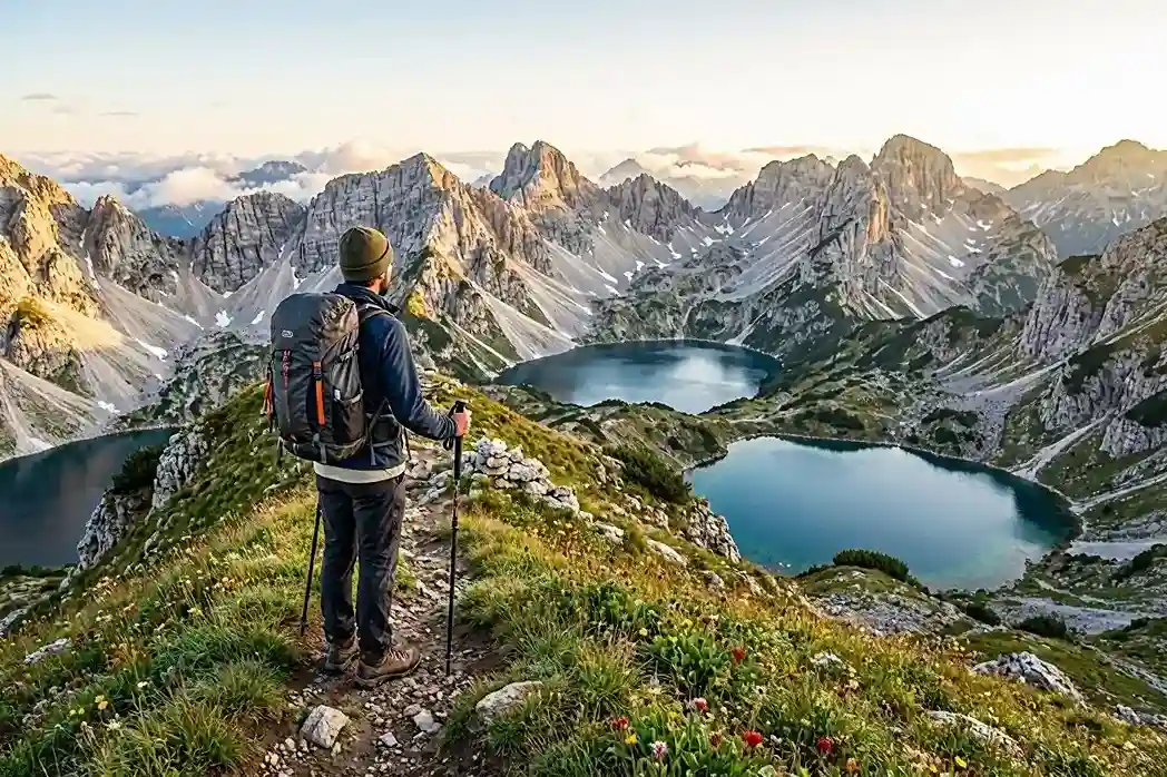
Via Dinarica Hiking Guide for Beginners: Best First Routes in 2026

Planning your first hike on the Via Dinarica is easier once you stop thinking of it as one continuous beginner trail. It is a developing network of long-distance corridors, official stages, local mountain paths, national-park routes, villages, huts and access roads spread across the Dinaric/Balkan region.
This Via Dinarica Hiking Guide for Beginners focuses on the decisions that matter most on a first trip: understanding the White, Green and Blue Trails, separating official Via Dinarica stages from easier local hikes in the same mountain areas, choosing a realistic route, checking current trail status, and planning navigation, water, accommodation, weather, transport and safety.
Table of Contents
Via Dinarica Hiking Guide for Beginners: Quick Answer
- Can beginners hike the Via Dinarica? Yes, if they choose a suitable individual stage or local introductory hike rather than assuming the whole network is beginner-friendly.
- Main official corridor: The White Trail.
- Green and Blue Trails: Both remain under development; use completed, documented sections rather than assuming continuous waymarking.
- Best first-trip style: A day hike, a weekend, or a short 2–7 day section with confirmed logistics.
- Most important planning rule: Current trail status is more important than an old GPX file.
- Navigation: Carry an offline route and know how to use it even on marked paths.
- Accommodation: Confirm every hut, guesthouse or overnight stop individually.
- Bosnia and Herzegovina: Mine safety requires strict route discipline and current local information.
What the Via Dinarica Actually Is
The Via Dinarica is a multi-country trail concept connecting mountain landscapes, communities and outdoor routes along the Dinaric Alps and neighboring areas. It is associated with seven countries across the Dinaric/Balkan region: Slovenia, Croatia, Bosnia and Herzegovina, Montenegro, Serbia, Kosovo and Albania.
It does not operate like a single uniformly engineered long-distance trail with identical signs, accommodation standards and transport connections from beginning to end. One stage can be straightforward to follow and supported by guesthouses, while another may cross remote karst terrain with limited water, changing waymarking and complicated access.
This is why headline figures for the total length of the Via Dinarica are less useful to a beginner than the details of the specific route you plan to hike. Daily distance, elevation gain, terrain, water, current condition, weather exposure, trailhead transport and the reliability of your overnight stop matter much more.
The official Via Dinarica information describes three main corridors: White, Green and Blue. The project also makes clear that the network can evolve over time as routes are developed, maintained or adjusted.
Read the official Via Dinarica trail overview.
White vs Green vs Blue: These Are Not Difficulty Ratings
A common beginner mistake is to read the trail colors as though they mean hard, medium and easy. They do not. The colors describe broad geographic and landscape corridors rather than a universal technical grading system.
| Trail | Main Character | What a Beginner Should Know | Development Status |
|---|---|---|---|
| White Trail | High mountains, major peaks, limestone ridges and alpine terrain | Contains both manageable sections and serious mountain stages; judge each stage individually | Defined main Via Dinarica route |
| Green Trail | Forests, lower mountains, inland landscapes, rivers and rural areas | “Green” does not mean “easy”; terrain and infrastructure still vary | Still under development |
| Blue Trail | Adriatic coast, islands, coastal mountains and Mediterranean hinterland | Rock, exposure and summer heat can make apparently modest routes demanding | Still under development |
The official trail page states that the White Trail is defined, while the Green and Blue Trails are still being developed and completed stages are added to the trail portal. For a beginner, this means you should plan around a confirmed route page rather than a colored line on a broad regional map.
Official Via Dinarica Stage vs Local Hike: Understand the Difference
This distinction is essential. Some excellent beginner walks are located inside famous Via Dinarica mountain regions but are not, by themselves, official Via Dinarica stages. That does not make them less worthwhile. In fact, they can be a smarter first step because they let you experience the same landscape while keeping navigation and logistics simpler.
| Experience | Country | Official Via Dinarica Stage? | Best Use for a Beginner |
|---|---|---|---|
| Premužić Trail | Croatia | Connected with the established Via Dinarica/Velebit route network | A first multi-day mountain experience for hikers already comfortable with full-day walking |
| Umoljani–Lukomir | Bosnia & Herzegovina | Documented on the official Via Dinarica trail portal | A first substantial mountain day for a fit beginner |
| Black Lake / lower Durmitor walks | Montenegro | Local national-park hikes in a Via Dinarica region | Low-risk introduction to the landscape before choosing a harder mountain route |
| Muvarnica | Bosnia & Herzegovina | Local beginner hike in the Blidinje area, not a complete White Trail stage | Gentle first exposure to the Blidinje mountain environment |
Can a Beginner Hike the Via Dinarica?
Yes—but the right question is “Which section?” rather than “Is the Via Dinarica easy?”
A good first route is one you can understand before you arrive. This Via Dinarica Hiking Guide for Beginners therefore treats route choice as a practical planning problem rather than trying to label one entire corridor as easy. You should know the approximate distance, climbing, terrain, expected time, water situation, escape options, overnight plan and trailhead transport. You should also have a current route source and a second navigation method.
A Strong Beginner Choice Usually Has
- A current official or locally maintained route description
- A downloadable GPX track plus an offline map
- Daily distance and elevation that match your training
- No technical climbing or via ferrata requirement
- A clear plan for water and food
- Confirmed accommodation if it is a multi-day trip
- Realistic transport to and from the trailhead
- A way to shorten or abandon the route if weather deteriorates
If you have never done consecutive mountain days, start with a day hike or weekend rather than a full thru-hike. A short trip teaches you far more about your footwear, pacing, water use, pack weight and recovery than planning an ambitious multi-week route from your desk.
How to Pick Your First Via Dinarica Experience
Start with the type of hiking day you can manage, not the most dramatic photo. A trail may be straightforward underfoot but inaccessible without a car, or physically easy yet exposed to severe weather. Choosing a good starting point involves both fitness and logistics.
| Your situation | Best first approach | Important limitation |
|---|---|---|
| You have never mountain hiked | Short, maintained lake or forest loop in Durmitor | A local park walk is not necessarily an official Via Dinarica stage |
| You can manage a 5 km walk on gentle terrain | Muvarnica viewpoint route in Blidinje | Confirm ground access and stay on the short marked option |
| You regularly hike 10–15 km with hills | Umoljani–Lukomir only if ascent, descent and transport suit you | The portal grades it moderate and calls for intermediate fitness |
| You have completed several long walking days | A planned portion of Premužić Trail | Remote hut and water logistics still demand preparation |
| You are seeking your first multi-day hike | A fixed base with separate day hikes near Žabljak | Prefer confirmed lodging and independent daily decisions |
A conservative beginner might aim initially for a route lasting two to four hours, then increase distance only after gaining confidence. These are planning examples, not an official Via Dinarica grading system. Fitness, weather, surface and elevation can make the same distance feel very different.
A Practical Go / No-Go Test
- Can you describe your complete route, including where you start, finish, and turn around?
- Is the current trail status confirmed by a responsible source or local hiking organization?
- Can you complete the planned climb and descent without relying on an untested fitness assumption?
- Do you know the last reliable water point and how you will return if you stop early?
- Is your route still sensible under tomorrow’s forecast, not just today’s sunny photographs?
If any answer is no, shorten the route or select a different hike. In remote mountains, switching plans is often the best evidence of good judgment—not a failed trip.
Best Ways for Beginners to Experience the Via Dinarica
1. Premužić Trail, Croatia: For Beginners Who Already Handle Full-Day Hiking
The historic Premužić Trail crosses the dramatic limestone landscapes of Velebit and is one of the most approachable ways to experience a genuine multi-day mountain environment without choosing an extremely steep high-alpine traverse.
The current Velebit Nature Park planning page explains that the historic alignment from Oltari to Baške Oštarije measured 57 km, while the route it currently presents from Zavižan to Baške Oštarije is about 42.6 km. Another official park page still uses 57 km for the Zavižan–Baške Oštarije description. That discrepancy is exactly why you should plan from the current map or GPX for your chosen itinerary rather than relying on one headline distance.
The trail was engineered to avoid severe gradients, and the current park page cites a maximum incline of roughly 10–12%. That makes the route more approachable than the surrounding terrain might suggest, but it does not turn Velebit into an effortless tourist walk.
Beginner reality check: Velebit can be remote, drinking water may be unavailable on some routes, weather can change quickly, and overnight logistics should be planned in advance. This is a good first multi-day option for someone who is already comfortable walking for a full day, not necessarily for someone doing their first mountain hike ever.
Check the current Premužić Trail information from Velebit Nature Park.
2. Žabljak and Lower Durmitor Walks, Montenegro: Best for Flexibility
Durmitor is famous for major peaks and serious mountain routes, but a beginner does not need to start with Bobotov Kuk, Prutaš or another demanding high route. The more sensible introduction is to stay in Žabljak and use it as a base for lower-level day hikes.
The official National Parks of Montenegro website lists 25 marked hiking and mountain trails in Durmitor with a combined length of about 150 km. Those routes range widely in difficulty. The educational circuit around Crno Jezero (Black Lake), for example, is about 3.6 km and is a much more appropriate first step than assuming every famous Durmitor summit is suitable for a new hiker.
This base-and-day-hike approach gives you an important advantage: you can adjust the plan each morning. If cloud, wind or storms make the high mountains a poor choice, you can select a lower route and still enjoy the park.
Important classification: Black Lake and many short walks around Žabljak are local Durmitor National Park hikes. The Via Dinarica White Trail crosses the wider Durmitor region, but you should not present every local park walk as an official Via Dinarica stage.
See the official Durmitor hiking information.
3. Muvarnica, Blidinje: A Gentle Local Introduction
Blidinje is closely associated with major Via Dinarica mountain landscapes, but a beginner should separate an easy local walk from the much more demanding White Trail stages crossing Čvrsnica.
The Muvarnica Forest Park walk is a useful example. Visit Blidinje describes it at roughly 5 km, around 2.5 hours and about 150 meters of elevation difference. Those figures make it far more suitable as a gentle introduction than treating a long Čvrsnica crossing as a beginner hike simply because both are in the same region.
Check the Muvarnica route information from Visit Blidinje.
4. Umoljani–Lukomir: A First Big Mountain Day for a Fit Beginner
The hike between Umoljani and Lukomir is often promoted to visitors staying in Sarajevo, but it should not be described as an effortless beginner stroll. The official Via Dinarica trail portal lists the hiking route at approximately 15.1 km, with about 782 m of ascent and 785 m of descent, and gives a walking time of around 5 hours 12 minutes. It also states that the route requires an intermediate fitness level.
That makes it a good target for an active beginner who has already trained on longer hilly walks. It is less appropriate as the first serious walk of someone who has never tested themselves over sustained climbing and descending.
View the official Via Dinarica information for the Umoljani area and route.
Real Transport Planning: Reaching the Trailhead and Getting Back
A trail can look simple on a mapping website and still be difficult to reach without a vehicle. Public transport normally serves towns and villages, not remote trailheads or mountain huts. The return journey is especially important for a linear hiking day. Before reserving a guesthouse, find out whether the advertised hike starts at a road, a valley settlement, a ski-area access point or several kilometers beyond the last bus.
Premužić: Do Not Forget the Linear Route
The Velebit trail is not a short loop where you can return to your parked vehicle in an hour. If walking a through-section, arrange both the start and end transport, and confirm the location and opening arrangements of your overnight hut or shelter. For a first visit with uncertain logistics, use a shorter out-and-back on a currently open park trail instead of booking multiple nights on the assumption that road pickups are always available.
Žabljak: Build a Base, Not a Complicated Transfer Chain
Žabljak is a more forgiving introduction because you can sleep in one place and choose a different route each day. However, do not equate arriving in town by bus with easy access to every Durmitor trailhead. Black Lake is relatively close to the town, while Sedlo and other mountain access points require a separate plan. Our Durmitor without a car guide explains which excursions are realistically accessible from Žabljak.
Sarajevo and Blidinje: Book the Return, Not Just the Arrival
For Umoljani–Lukomir, confirm whether the selected hike is a loop or a point-to-point route and whether the driver can meet you where it finishes. Public buses to Sarajevo do not solve the last mountain-road connection. The same principle applies to Muvarnica: check how you reach Vitlenica, whether the access road is suitable for your vehicle, and how you will leave if weather changes. For easier alternatives closer to the city, consult our Sarajevo hiking trails guide.
Whenever you use a taxi or transfer, agree the exact pickup point, pickup time and price before you start. Save a local contact number and have enough flexibility that a delayed return will not force you to continue an unsafe route after dark.
Current Trail Closures and Maintenance: Your GPX Is Not the Final Authority
Via Dinarica is an evolving trail network. Route maintenance, floods, landslides, damaged roads, rerouting and renewed waymarking can all change what is practical on the ground.
A particularly important example is the Plasa–Jablanica section, Stage 30 / BH-W-05. An official Via Dinarica notice published in June 2025 said the section was temporarily closed after major damage to the lower trail and published alternative routes. The 2025 closure notice remains publicly accessible, while some route-map status labels may differ from individual closure notices. This guide cannot establish that the damaged descent is safely reopened.
That mismatch is precisely why a beginner should not make a go/no-go decision from one old GPX file or one status label. There has also been active maintenance: Via Dinarica reported work on Vran and Čvrsnica in June 2026 and broader maintenance and renewed markings across Čvrsnica, Prenj, Bjelašnica, Visočica, Igman, Jahorina, Treskavica, Zelengora and Vlašić in September 2026.
Čvrsnica–Jablanica Trail-Status Warning
Before entering any multi-day Čvrsnica–Jablanica section, check the current Via Dinarica news/status pages and obtain recent local information. Do not assume that a downloaded GPX proves the route is currently passable, and do not assume that maintenance work automatically means every previously closed stage has reopened.
Check current Via Dinarica news and trail notices before departure.
Before Every Hike: Check Three Things
- The official or current route page. Confirm distance, elevation, expected duration and the route file you actually intend to follow.
- Recent closure, maintenance or diversion notices. Look for updates newer than the GPX you saved.
- Weather and local mountain information. A technically open trail can still be a poor choice in snow, storms, extreme heat, strong wind or after major rainfall.
2026 Route-Status Example: Why One Source Is Not Enough
The official Via Dinarica notice dated 8 June 2025 described damage and a temporary closure on Plasa–Jablanica (Stage 30, BH-W-05). A separate update on 8 September 2026 described maintenance and improved markings across several Bosnian mountain regions. These two reports refer to different activities: broad trail maintenance does not necessarily certify that every previously damaged descent is passable.
Do not attempt to infer an all-clear from a generic “open” indicator on a mapping platform. Contact the responsible route organization or local mountain club, request the most recent information for the exact descent you intend to use, and ask whether an alternative is currently required. This is a good example of why an article should describe how to confirm conditions rather than promise the present state of a remote path months in advance.
Official evidence: June 2025 stage closure notice and September 2026 maintenance report.
Mine Safety in Bosnia and Herzegovina
Mine risk is not a reason to avoid all hiking in Bosnia and Herzegovina, but it is a reason to follow confirmed routes with discipline and to use current information rather than improvising across unknown ground.
The revised Bosnia and Herzegovina Mine Action Strategy for 2025–2027 records 838.29 km² of mine-suspected area using a January 2024 baseline. That figure is useful as context, but it should not be treated as a live map for your hike. Clearance and survey work changes the situation over time.
EUFOR’s minefield-map guidance states that its maps show known contamination and that other areas should still be treated with caution, with updated information available from the Bosnia and Herzegovina Mine Action Centre (BHMAC).
Mine-Safety Rule
Stay on the confirmed route and never shortcut across unverified terrain in mine-affected regions. Do not assume that ground beside a marked trail is automatically cleared, and do not rely on warning signs alone as proof of where every hazard is located.
See EUFOR’s Bosnia and Herzegovina minefield-map information.
Navigation and GPX: Build Redundancy Into Your Plan
Waymarking quality varies. Some stages are well marked; other sections may follow local roads, forest tracks or older mountain paths where signs are less consistent. A phone with an offline route is valuable, but it should not be your only plan.
Before departure, download the route and surrounding map for offline use. Keep your phone charged, carry a power bank, and know how to identify your position without a mobile signal. If you are hiking a remote stage, a paper map or a second navigation device can add useful redundancy.
Most importantly, understand the difference between navigation data and trail-status data. A GPX line tells you where a route was mapped. It does not prove that a bridge is intact, a descent is safe, a hut is staffed or a landslide has been cleared today.
Water in Karst Terrain
The Dinaric mountains are famous for limestone and karst. One consequence is that surface water can be less reliable than the green landscape suggests. A spring shown on an old map may be seasonal, dry, difficult to locate or unsuitable for drinking.
Check water sources for the exact stage, ask accommodation providers or local mountain organizations when possible, and carry enough capacity for the longest dry section. If you are uncertain about a natural source, use an appropriate treatment method rather than assuming clear water is safe.
Velebit provides a good example of why this matters: official park descriptions for some hiking routes explicitly tell hikers to bring drinking water because none is available on the route.
A Pre-Departure Checklist for Every Overnight Stop
For multi-day routes, sleeping arrangements are part of your safety system. A listing may describe a shelter as “always open” while also saying it is unstaffed, has no food and has no reliable water. The official Velebit accommodation directory contains precisely this kind of detail, which is why it is more useful than simply finding a hut icon on an outdoor map.
- Ask whether beds can actually be reserved or the shelter is first-come, first-served.
- Confirm access procedures: a key, caretaker, booking confirmation or membership may be required.
- Check water, toilets, cooking facilities, heat and availability of electricity.
- Ask whether dinner, breakfast and packed lunch are offered; never assume they are included.
- Note the nearest alternative overnight and how far it is along a marked route.
- Carry any cash necessary for the hut or transfer, and know your cancellation rules.
If you cannot verify a safe overnight stop, redesign the itinerary as day hikes from a town or guesthouse. On your first Via Dinarica trip, carrying less uncertainty is more valuable than collecting one extra remote stage.
Mountain Huts and Guesthouses: Confirm Every Overnight
A hut symbol on a map does not guarantee a staffed lodge, a bed, dinner or even an unlocked building. Across the Via Dinarica region you may encounter staffed mountain lodges, simple shelters, self-catering huts, bivouacs and rural guesthouses, all operating differently.
For a beginner multi-day trek, the safest planning rule is simple: confirm every overnight individually before you commit to the itinerary. Ask whether the place is open on your date, whether reservation is required, whether food is served, whether bedding is provided, how payment works and whether drinking water is available.
Guesthouse-based trips can be easier than hut-to-hut hiking because they reduce the amount of food and sleeping equipment you need to carry. A base such as Žabljak can also simplify your first trip by letting you choose day routes according to weather.
Affiliate disclosure: The booking links below may be affiliate links. If you book through them, Balkan Trip Guide may earn a commission at no additional cost to you. The trail-planning advice in this guide is independent of those links.
If you plan to use Žabljak as a hiking base, you can compare accommodation in Žabljak on Agoda. Check the actual location, cancellation terms and whether the property can help with early breakfast or trailhead transport if you need it.
Weather and the Best Season for a First Trip
There is no single “best month” for the entire Via Dinarica. Elevation, latitude, coastal exposure and the previous winter all matter. A route that is comfortable on the Adriatic side in spring may still have snow problems higher in the mountains.
For many high-mountain beginner itineraries, the period after reliable snowmelt and before autumn conditions become unstable is the easiest planning window. Lower and coastal routes can be attractive in spring and autumn, while midsummer heat may make exposed Blue Trail terrain harder than its elevation suggests.
Do not choose dates from a generic seasonal chart alone. Check the specific mountain, recent snow conditions, heat warnings, thunderstorms, wind and local advice shortly before your hike. Build enough flexibility into the itinerary to change a route rather than forcing the original plan in poor conditions.
Border Crossings: Keep Your First Trip Simple
The Via Dinarica crosses several countries, but a first trip does not need to. For a beginner, an itinerary contained within one country removes a layer of complexity and lets you focus on the hiking itself.
If you later plan a cross-border mountain route, verify the legal crossing procedure for the exact countries, crossing point and your nationality. Requirements can differ between official road crossings and remote mountain crossings, and border rules can change. Do not assume that a hiking line on a map automatically gives you permission to cross anywhere along it.
Mountain Decision-Making: When to Turn Around
Beginners sometimes treat reaching a summit or village as the objective. The real objective is returning safely with daylight and energy remaining. Start with a predetermined turnaround time. If you reach that time without the expected progress, return even if the destination is close on the map.
- Turn back when thunder is developing or wind makes exposed sections uncomfortable.
- Shorten the plan when snow, ice or wet limestone makes traction uncertain.
- Stop and reassess if water consumption is much higher than planned.
- If signs or your map no longer agree, do not shortcut across unfamiliar slopes.
- If fatigue causes repeated slips or poor decisions, seek the safe planned exit rather than pushing onward.
In Bosnia and Herzegovina, the rule against off-trail shortcuts is especially important because former mine contamination may remain in some areas. Never explore an apparently convenient unmarked clearing or abandoned path to “save time.” In high mountain country elsewhere, unmarked shortcuts also risk cliffs, loose rock and navigation errors.
What to Pack for a Beginner Via Dinarica Hike
Your equipment should match the section rather than a generic “Balkan trek” packing list. A summer day hike near Žabljak needs different equipment from a remote multi-day crossing on Velebit or Čvrsnica.
- Footwear: broken-in hiking shoes or boots with grip appropriate to rocky terrain
- Rain and wind protection: mountain weather can change quickly
- Warm layer: useful even when the valley forecast looks hot
- Sun protection: hat, sunscreen and sunglasses for exposed limestone terrain
- Water capacity: sized for the longest confirmed dry section
- Navigation: offline map, GPX route and backup power
- Food: enough for the planned day plus a small emergency margin
- Basic first aid: including blister care
- Headlamp: even if you expect to finish in daylight
- Identification and cash: useful for remote accommodation and transport
Do not carry heavy equipment simply because you are hiking a famous long-distance trail. If you are sleeping in confirmed guesthouses and huts, you may be able to keep your pack far lighter than someone camping independently.
How to Train for Your First Via Dinarica Section
Train for the specific stress of the route. Distance on flat ground is useful, but repeated climbing and descending is what surprises many first-time mountain hikers.
In the weeks before your trip, build progressively toward longer walks with hills while carrying the shoes and pack you expect to use. If your target is something like Umoljani–Lukomir, make sure you have already completed a long hilly day rather than using the route as your first test of sustained elevation.
For a multi-day itinerary, try two substantial walks on consecutive days during training. The second day often reveals problems with feet, recovery and pack fit that a single day does not.
Budget: Plan by Category, Not One Daily Number
The Via Dinarica crosses countries and regions with very different tourism infrastructure, so a single daily budget creates false precision. A more useful approach is to price the exact trip by category.
| Category | What Changes the Cost |
|---|---|
| Accommodation | Hut, guesthouse, hotel, shared room, private room and location |
| Food | Self-catering vs restaurant meals, whether a hut serves dinner, and how often you can resupply |
| Trailhead transport | Public bus, taxi, private transfer, rental car and whether the route is linear |
| Guide | Private vs group trip, technical difficulty, transport included and route duration |
| Park or access fees | National park and local access rules |
| Insurance | Trip length, destination, age, hiking altitude and activity exclusions |
On remote routes, getting to and from the trailhead can cost more than the hiking itself. Always price the last connection before booking accommodation around a route.
Mobile Data and Offline Use
Mobile data is convenient for weather updates, messaging accommodation and checking transport, but it should not be required for basic navigation. Download your maps, booking details, route notes and emergency contacts before leaving reliable coverage.
If your trip crosses several countries and your phone supports eSIM, a regional plan can be convenient. You can compare Airalo’s Europe eSIM options, but confirm that the specific countries in your itinerary are included before buying.
Travel Insurance: Read the Hiking Exclusions
Do not choose a policy only because the product page says “travel insurance.” Check whether hiking at your expected altitude is covered, whether mountain rescue or evacuation is included, whether guided and unguided hiking are treated differently, and whether any planned activity is excluded.
You can compare international travel-insurance options through VisitorsCoverage. Read the policy wording and exclusions for your exact route before purchasing; a comparison platform is not a substitute for checking the actual policy certificate.
When a Guide Is Worth Paying For
You do not need a guide for every Via Dinarica hike. A guide becomes more valuable when the difficulty comes from uncertainty rather than just distance.
- Your first substantial alpine day
- Complicated trailhead or return transport
- A route involving recent closures, diversions or uncertain conditions
- A cross-border itinerary with additional logistics
- Low confidence in mountain navigation
- A route where weather decisions may require strong local judgment
If you prefer local help in Montenegro, you can browse hiking experiences around Žabljak on GetYourGuide. Compare the actual route and difficulty rather than booking solely from the photos; Durmitor products can range from easy walks to demanding summit hikes.
Alternative Three-Day Beginner Itinerary: Žabljak and Durmitor
A town-based Durmitor break is often the better first hiking trip if you have never walked in high mountain terrain. It avoids the need to move accommodation daily, and you can replace a more exposed outing with a shorter route if conditions change.
| Day | Plan | Why it works |
|---|---|---|
| 1 | Arrive in Žabljak, confirm park information and transport, take a short orientation walk | Allows time to check the weather and adjust expectations |
| 2 | Walk the Black Lake educational circuit (officially around 3.6 km) and optionally extend only on suitable marked routes | Builds confidence without committing to a summit |
| 3 | Choose another low-level walk if conditions permit; otherwise rest and travel onward | Makes weather flexibility part of the plan |
A second low-level option should be chosen using current park guidance and the hiker’s fitness. For seasonal detail, see our off-season Durmitor hiking guide. The official park lists many routes with very different requirements; a simple first day does not prepare everyone for Bobotov Kuk the next morning.
If your longer Balkan trip includes Albania, the Theth hiking guide, Valbona Valley hiking guide and Komani Lake ferry guide provide distinct planning details. Theth–Valbona should not be treated as a beginner replacement for a Black Lake loop merely because both are in the Dinaric region.
Example First Via Dinarica Weekend from Sarajevo
A short Sarajevo-based trip can work well for a fit beginner because it combines one substantial hiking day with simple city logistics.
Day 1: Arrive, Prepare and Check Conditions
Stay in Sarajevo, confirm your transport to the trailhead, download the current route, check the weather and pack water, food and layers. Do not leave these tasks until the morning of the hike.
Day 2: Umoljani–Lukomir for a Fit Beginner
Choose the full route only if your fitness matches a roughly 15 km mountain day with substantial ascent and descent. If not, replace it with a shorter local walk rather than turning the trip into an endurance test.
Day 3: Recovery and Departure
Keep the final day easy. This gives you buffer if transport or weather causes a delay and avoids stacking another hard mountain day immediately after your first major hike.
Respecting Mountain Communities and the Landscape
Via Dinarica is about more than a walking line on a map. Many routes pass working farms, summer pastures and villages where families live and earn their income. Ask before photographing residents, close gates as you found them, leave livestock undisturbed and stay on the agreed path when it crosses private land.
Carry out your rubbish and food packaging. Do not assume remote shelters have waste collection, and do not wash dishes directly in springs or streams. Water may be scarce in karst areas, and these sources can be important to households and livestock. Use established accommodation and local transport providers when appropriate; doing so can help sustain the communities that keep mountain access possible.
Useful Official Resources to Save Before You Go
- Via Dinarica trail overview for understanding the White, Green and Blue corridors.
- Via Dinarica route portal for named stages, elevation, navigation files and stage notes.
- Via Dinarica news for the latest maintenance and closure announcements.
- Velebit Nature Park hiking directory and accommodation directory for Croatian route and hut details.
- Durmitor National Park hiking information for named trail options.
- EUFOR minefield-map guidance and BHMAC for current mine-safety information in Bosnia.
Frequently Asked Questions
Can complete beginners hike the Via Dinarica?
Complete beginners can enjoy the Via Dinarica region, but the best first experience may be a local park or valley hike rather than an official high-mountain stage. Build experience before committing to long remote sections.
Which Via Dinarica trail is easiest?
There is no useful answer at corridor level. White, Green and Blue are not official difficulty grades. Compare individual stages by distance, elevation, terrain, navigation, access, water and current conditions.
Should a beginner hike the entire Via Dinarica?
For most first-time long-distance hikers, no. Start with a day hike, weekend or short multi-day section. A thru-hike adds resupply, changing conditions, international logistics, foot management and weeks of accumulated fatigue.
Is the Via Dinarica well marked?
Waymarking varies by stage and country. Some sections are well marked, while roads, developing sections and remote terrain can be less consistent. Carry offline navigation even when you expect signs.
Do I need a tent?
Not necessarily. Many beginner itineraries can be built around guesthouses, hotels or confirmed huts. Carrying camping equipment only makes sense if your route and legal camping plan require it.
Can I drink from mountain springs?
Do not assume every spring is reliable or safe. Confirm water locations for your exact route, carry enough capacity and use treatment when the source is uncertain.
Do I need a guide?
Not for every route. A guide is most useful when navigation, current closures, weather judgment, transport or a more demanding mountain objective creates uncertainty you are not ready to manage independently.
Is Umoljani–Lukomir an easy beginner hike?
No. The official portal lists a 15.1 km route with roughly 782 m ascent and 785 m descent and describes it as requiring intermediate fitness. It can suit a fit beginner who has trained for longer hilly days.
Is Premužić Trail easy?
Its engineered gradients make it more approachable than many rugged high-mountain routes, but remoteness, water planning, weather and overnight logistics still matter. Think “accessible multi-day mountain route for a prepared beginner,” not “effortless trek.”
Can I rely on an old GPX file?
No. Use GPX for navigation, but check current route pages, closure or maintenance notices and local weather before every hike. The Plasa–Jablanica status discrepancy is a good example of why current verification matters.
Final Thoughts: Start Small, Then Build Up
The Via Dinarica is a rewarding first Balkan hiking project precisely because you do not need to tackle the entire network. The central lesson of this Via Dinarica Hiking Guide for Beginners is to choose the route that matches your actual experience and gives you enough margin to enjoy the mountains rather than merely survive the itinerary.
For a very gentle start, use a local hike such as Muvarnica or a lower Durmitor route to learn how the landscape feels. If you already handle full-day hiking, consider a carefully planned Premužić itinerary. If you are fit and trained for hills, Umoljani–Lukomir can provide a more substantial first mountain day.
Whatever you choose, treat the trail as a living network. Confirm the route, read the newest notices, check weather and water, verify your overnight stops, stay disciplined in mine-affected areas, and carry offline navigation. That approach is more useful than trying to identify one “easiest” Via Dinarica trail.
Before You Leave
Official route page → current closure/news notice → weather/local mountain information. Check all three before every hike. If they disagree, treat the uncertainty itself as a reason to get newer local confirmation before committing to the route.