Theth Albania Hiking Guide 2026: Trails, Costs & Safety

This Theth Albania hiking guide is designed for travelers who need more than inspiring mountain photos: the right hiking season, realistic trail distances, reliable transport, where to sleep, what to budget and how to get home safely. Theth is a small mountain village in northern Albania, surrounded by the steep limestone scenery of the Albanian Alps. Its famous walks range from an approachable waterfall excursion to exposed passes and serious summit terrain.
A successful visit begins with choosing the right route for your fitness and the actual conditions on the day. The walk from Theth to Valbona is a full point-to-point mountain crossing, not a short village stroll. The Blue Eye sits down the valley near Ndërlysa, not on the Valbona Pass trail. Higher trails can retain snow well into June, even while village paths are green.
This guide uses official protected-area information, transport-operator timetables and local route descriptions checked in October 2026. Published prices, departure times and trail conditions can change. Reconfirm them before travel and ask your guesthouse about the precise route conditions on the morning of every hike.
Table of Contents
Theth Albania Hiking Guide: Quick Answers
| Question | Practical answer |
|---|---|
| Where is Theth? | In the northern Albanian Alps, reached mainly via Shkodër. |
| Best season? | Usually July to September for high mountain passes, once snow and weather allow; some valley walks can be possible earlier or later. |
| How long to stay? | Two or three nights for a village base; more time if crossing to Valbona. |
| Easiest signature walk? | Grunas Waterfall, roughly 2–3 hours return from central Theth, depending on your starting point. |
| Blue Eye access? | Drive or arrange a shared transfer to Ndërlysa, then walk around 40–60 minutes each way on rough trails. |
| Theth–Valbona? | A full-day one-way hike, roughly 14–20 km depending on trailhead; arrange lodging and onward transport. |
| Emergency number? | 112; mobile service in the mountains can be unreliable. |
| Cash or card? | Bring sufficient Albanian lek from Shkodër; do not count on a working ATM or card reader in Theth. |
Safety first: Before attempting Valbona Pass in May or June, read the 2026 response from Albania’s National Agency of Protected Areas. In late May 2026 it warned of remaining snow and hazardous sections and recommended experienced local guides for an early-June crossing. No calendar month guarantees that a pass is safe.
Where Is Theth, and Is It Still Theth National Park?
Theth (also written Thethi) occupies a mountain valley north of Shkodër, at approximately 700–800 m elevation depending on the location. The village is historically associated with Theth National Park. For current administration, however, the former Theth and Valbona Valley national parks and the Gashi River protected area were combined in 2022 to create the larger Alps of Albania National Park. The Albanian National Agency of Protected Areas explains the updated designation. Older guides and local businesses may continue using the familiar name “Theth National Park.”
The landscape features the Shala River, forested slopes, limestone gorges, isolated hamlets and mountains rising well above 2,000 m. Even if you do not attempt a summit, short walks around the valley reveal why this is a highlight of northern Albania. Tourism facilities have improved, but the destination remains rural: road conditions, weather, cash access and mountain rescue response should all be taken seriously.
Best Time to Hike in Theth: Valley Walks vs High Passes
| Period | Valley routes | Valbona Pass / high terrain | Planning implication |
|---|---|---|---|
| March–May | Weather-dependent; snowmelt and wet trails | Snow and avalanche risk commonly remain | Do not book a high-pass hike on seasonal assumptions. |
| June | Waterfalls and low-level excursions often appealing | Conditions vary greatly; snow may persist | Ask protected-area staff or qualified local guides. |
| July–August | Popular; warm valley days | Often primary hiking window, weather permitting | Start early; reserve guesthouses and transport. |
| September | Often comfortable | Commonly favorable when conditions remain stable | Shorter days toward month-end; verify forecast. |
| October | Some lower routes may remain passable | Frost, early snow and closures increasingly possible | Avoid treating October as guaranteed hiking season. |
| November–February | Snow and difficult access possible | Winter mountaineering conditions | Not a casual independent summer-style visit. |
Mountain safety depends on the day, not only the month. Rain can make stream crossings dangerous; fog can obscure navigation; thunderstorms can develop quickly around exposed ridges. Summer also brings heat and dehydration risk in the valley. The practical test is whether the individual route is clear, the weather forecast is suitable, and your group has the skills and equipment to complete it.
For broader seasonal planning, compare the best time to visit the Balkans by month. Remember that a warm forecast for Shkodër or Tirana cannot confirm conditions at Valbona Pass.
Getting to Theth from Tirana and Shkodër
Shkodër to Theth: the usual mountain shuttle
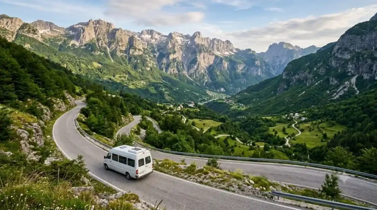
Shkodër is the most practical gateway. The paved SH21 mountain road leads through the Qafë Thorë area to Theth. Driving may take roughly two to three hours in suitable conditions, but the curves, weather and mountain traffic mean the journey should not be timed like a highway transfer.
As of the October 2026 review, the Demar by Berisha operator listed Shkodër–Theth departures at approximately 07:30 and 14:00 for €12 per person each way. Another timetable from the related Berisha ferry service lists a morning departure at 07:00. These are operator-specific listings, not a guarantee of a nationwide daily timetable. Check the exact provider, meeting point, departure date, baggage allowance and return journey before paying.
Do not confuse the departure points: Some services advertise pickup near central Shkodër landmarks such as Hotel Rozafa, while others use operator-specific meeting points. Your booking confirmation is more reliable than a location copied from an old blog.
Tirana to Theth: through transfer or change at Shkodër
From Tirana, compare a bookable through minibus or transfer with a regular service to Shkodër followed by the mountain shuttle. Allow a full travel window rather than assuming all connections will line up. A late flight arrival in Tirana may make an overnight stay in Shkodër the safer choice. Our Tirana to Theth bus guide covers the connection patterns, current departure examples and return logistics in more detail.
If you are arriving by air, compare flights to Tirana on Trip.com before choosing an onward bus connection. Avoid booking a same-day mountain minibus with no margin for immigration, luggage collection or traffic.
Can you drive to Theth?
A conventional car can often use the paved main route in suitable weather, but that does not make winter travel risk-free. Check the latest road and weather information, your vehicle suitability, parking arrangements and rental company conditions. Mountain snow and landslides can interrupt access. If driving is mainly for a two-night hiking stay, a shuttle may be simpler than leaving a rental car unused.
The Best Hikes in Theth: Distance, Difficulty and Logistics
The table below compares common routes from the Theth area. Distances are approximate route-planning ranges because guesthouse locations, trailheads and vehicle transfers change the recorded length. They should never replace a current map, a local route briefing or an assessment of the weather.
| Hike | Typical outing | Difficulty | Critical detail |
|---|---|---|---|
| Grunas Waterfall | Roughly 4–6 km return; 1.5–3 hours | Easy–moderate | Rock can be slippery; not a flat paved family path. |
| Blue Eye via Ndërlysa | About 4 km return on foot from the lower trailhead; allow half day with transfer | Easy–moderate | Must first reach Ndërlysa; steep/rough sections. |
| Blue Eye entirely on foot from Theth | Approximately 18–22 km return, depending on route | Moderate–strenuous | A genuinely long outing; not the short shuttle version. |
| Theth to Valbona via pass | Roughly 14–20 km one way; allow 6–9 hours or more | Strenuous mountain day | One-way traverse requiring overnight/onward plan. |
| Peja Pass / Qafa e Pejës | About 10–14 km return; often 5–7+ hours | Strenuous | Steep, loose and exposed ground near the pass. |
| Arapi / Maja e Harapit summit | A full-day, often 8–10+ hours | Very difficult / scramble | Not a general walking route; experienced party and guide recommended. |
1. Grunas Waterfall: a good first-day trail
Grunas Waterfall (Ujëvara e Grunasit) is a practical introduction if you arrive early enough and the paths are dry. From central Theth, allow roughly two to three hours for the return, plus photography breaks. Some shorter times quoted online start at a bridge or closer trailhead rather than your guesthouse. This distinction explains apparently conflicting numbers.
Although it is one of the more accessible hikes, expect stones, uneven trail and wet surfaces near the waterfall. Wear grippy shoes. Do not step onto slick rocks to approach the plunge pool, and avoid the gorge during high water. A family may enjoy this route if every member can walk safely on uneven surfaces, but it is not stroller-accessible.
2. Blue Eye of Theth: choose your starting point
The Blue Eye of Theth (Syri i Kaltër i Thethit, sometimes called the Blue Eye of Kaprre) is an intensely blue spring near Ndërlysa, down the valley from the main village. It is a different attraction from the Blue Eye near Sarandë in southern Albania. It is also not a twenty-minute diversion from the Theth–Valbona Pass route.
There are two sensible ways to plan the visit. Arrange a shared vehicle or driver for the roughly 7–9 km trip from Theth to Ndërlysa, then walk the final section on foot, often about 40–60 minutes each way. Alternatively, walk from central Theth to Ndërlysa as well; this creates a much longer full-day trip, especially if you walk both directions. Route descriptions differ according to the exact village starting point and whether the traveler takes a vehicle partway.
Ask your guesthouse to arrange any transfer in advance, confirm the driver’s return time and leave room for a slower descent. The final path includes rocky steps and may be slippery. The spring is exceptionally cold and the pool may be deep; swimming is not a sensible default recommendation, particularly for children or anyone unprepared for cold-water shock.
3. Theth to Valbona: a full-day, one-way mountain traverse
The route crosses Qafa e Valbonës (Valbona Pass), approximately 1,795 m, between two separate valleys. It is often described as a 14–17 km trek, but hikers who begin farther from the pass or finish at a distant guesthouse can walk closer to 20 km. Allow around six to nine hours or longer, including steep ascent, long descent and breaks. The route is not a simple loop back to the same accommodation.
Theth-to-Valbona hikers generally climb out of Theth and descend toward the Valbona side, then sleep in Valbona or use separately arranged onward transport. Hikers going the other direction do the reverse. Ask your two guesthouses about trailhead transfers, luggage transportation if offered and the exact walking distance from the end of the trail to your bed. Do not rely on being able to take a quick taxi straight back over the mountains.
This is a strenuous walk for someone unfamiliar with steep mountain paths, even when dry. It can involve approximately 1,000 m of climbing from the Theth side, although recorded ascent varies by start point and track. Snow, ice, loose rock, thunderstorms and poor visibility can change the difficulty dramatically. The official protected-area warning issued in May 2026 specifically cautioned about the early-June crossing; confirm current conditions before proceeding.
For details from the opposite valley and the Koman ferry loop, use our Valbona Valley hiking guide.
A one-way hike needs a one-way plan: Do not put “Theth to Valbona” on Day 3 of a Theth-only itinerary and then schedule another Theth hike the next morning without explaining how you will return. The crossing usually ends with a night in the opposite valley. The drive between valleys is not a short road transfer.
4. Peja Pass / Qafa e Pejës: strenuous ascent, not a shortcut to Kosovo
Qafa e Pejës rises to approximately 1,742 m above the Theth valley. Its steep approach and loose upper section make it a serious hike even though it can be completed as an out-and-back by experienced walkers. Different sources report around 5–7 km each way depending on where they measure from. Avoid using a single “20 km to Kosovo” description: Peja Pass is not a routine direct border crossing into the city of Peja in Kosovo.
The pass belongs to the wider mountain network used in long-distance routes through the Albanian Alps, including routes connected with the Peaks of the Balkans circuit. A trip beyond the pass toward an international frontier is a separate multi-day or cross-border undertaking with its own legal requirements. For the day hike, return by the same route; carry adequate water and do not continue into unfamiliar terrain just because a footpath is visible.
5. Maja e Harapit (Arapi Peak): summit terrain for experts
The limestone tower of Maja e Harapit, approximately 2,218 m, dominates views from the Theth valley and the Peja Pass area. Reaching the summit may involve very steep, exposed scrambling where a fall could have severe consequences. Some climbing lines on the mountain are technical rock climbs. Do not treat a summit ascent as an ordinary marked walk suitable for anyone with good fitness.
Travelers who are not experienced on exposed rocky mountain terrain can still enjoy dramatic views of the peak from the valley or Peja Pass. A guided summit attempt should be considered only after discussing the route, technical difficulty, equipment, weather and group experience with a qualified local mountain guide. A mountain-view hike and an attempt on the summit are different products.
Theth Hiking Trails: Which Route Should You Choose?
| Your experience | Suggested objective | What to avoid |
|---|---|---|
| Little hiking experience | Village landmarks; Grunas Waterfall in suitable weather | High passes, exposed scrambling and long unplanned days. |
| Comfortable on uneven trails | Blue Eye via a transfer to Ndërlysa | Assuming the full village-to-spring walk is short. |
| Fit day hiker with navigation experience | Valbona Pass after local conditions check | Starting without onward lodging or with snow on the route. |
| Strong experienced mountain hiker | Peja Pass in settled weather | Mistaking the pass for an easy border shortcut. |
| Experienced scrambler/mountaineer | Arapi summit with expert route advice | Attempting unfamiliar exposed terrain alone. |
Difficulty labels are only general screening tools. Conditions, pack weight, exposed terrain, altitude, navigation and personal health matter more than whether an online map labels a hike “moderate.” When in doubt, choose a shorter trail or hire a suitable guide.
A Practical Theth Hiking Itinerary: 2, 3 or 4 Days
Two nights in Theth: the easy-to-moderate option
- Day 1: Travel from Shkodër or Tirana, check into your guesthouse, walk around the village, church and Lock-in Tower if open. Add Grunas Waterfall only if you have time, daylight and appropriate weather.
- Day 2: Arrange a transfer to Ndërlysa for the Blue Eye walk. Return to Theth, enjoy a relaxed afternoon, and confirm tomorrow’s return minibus.
- Day 3: Travel back to Shkodër. Leave a buffer before onward flights or international buses.
This plan keeps you in one village for two nights and avoids forcing a long mountain crossing into a short trip.
Three nights in Theth: more flexible valley hiking
- Day 1: Arrive and explore the village.
- Day 2: Grunas Waterfall and appropriate valley viewpoints, allowing time for rest.
- Day 3: Blue Eye via Ndërlysa, with the option to walk more of the valley route if conditions and fitness permit.
- Day 4: Return to Shkodër or continue elsewhere by confirmed transport.
This is a good plan for travelers who want multiple hikes but no forced high-pass commitment. If the weather turns, replace a longer walk with cultural sightseeing and an easy valley walk.
Theth to Valbona crossing: plan an extra overnight in Valbona
- Day 1: Reach Theth and settle in.
- Day 2: Choose Grunas Waterfall or the Blue Eye; prepare a daypack and confirm trail conditions.
- Day 3: Hike one way from Theth over Valbona Pass, only if the pass is safe; stay overnight in Valbona.
- Day 4: Continue through Valbona transport connections toward Fierzë, Lake Koman and Shkodër, or remain in the valley. Confirm all segments and seasonal ferry arrangements in advance.
The reverse loop also works: Shkodër → Koman ferry → Fierzë → Valbona → hike to Theth → shuttle back to Shkodër. Ferry operators publish distinct departure seasons and times; check the operator timetable and connect all legs before booking. Our Albania two-week itinerary illustrates how the mountain crossing can fit into a broader journey.
Do You Need a Hiking Guide in Theth?
A guide is not generally mandatory for all valley trails, but a local guide can be valuable for remote routes, uncertain seasonal conditions or groups with limited mountain experience. An independent hike should be based on current route knowledge, sound navigation, realistic fitness and a safe weather window—not solely on seeing other hikers set off. In particular, exposed terrain above Peja Pass and the Arapi summit deserve specialized assessment.
When comparing a guided outing, check the exact route, experience requirements, group size, meeting place, equipment, transport, guide qualifications and whether the price includes a return. You may browse available Theth tours and hiking experiences on GetYourGuide for ideas, but availability and suitability depend on the specific operator and date. A promotional listing should never override adverse weather or a local closure warning.
Where to Stay in Theth: Guesthouse Location Matters
Theth has a mix of family-run guesthouses (bujtina), small mountain hotels and a few camping options. Accommodation spread along the valley may be several kilometers apart. Two properties both advertised “in Theth” can require significantly different walking times to the church, Blue Eye transfer pickup or a long-distance trailhead. Check the map pin, foot access, baggage transport and whether your host can arrange a transfer.
Ask whether breakfast and dinner are included in the room price, whether a packed lunch is available for your long hiking day, what time meals are served and whether the property takes cards. Some guesthouses quote a per person half-board rate while others quote a per room rate plus meals, so compare like with like.
You can compare guesthouses in Theth on Agoda and then check the property’s exact location and current meal arrangements. For environmentally considerate local stays, see our guide to sustainable Theth experiences.
How Much Does Hiking in Theth Cost in 2026?
Many natural walks have no ticket fee, but travel, accommodation, meals and optional guides are real expenses. The following are indicative 2026 planning figures, not guaranteed quotes. Prices vary with room type, summer demand, shared transfers and currency exchange; ask the supplier before booking.
| Expense | Approximate planning figure | Notes |
|---|---|---|
| Shkodër–Theth minibus | €12 each way (published operator example) | Route, exact time and seat must be confirmed. |
| Family guesthouse room | Often around €30–60+ per room per night | Room prices, food inclusion and peak dates vary. |
| Half-board in simpler guesthouse | Roughly €20–40 per person/night in some offers | Check whether breakfast, dinner and bathroom are included. |
| Guesthouse dinner if separate | About €8–15 per person | Reserve with host; options limited outside the village. |
| Blue Eye transfer to Ndërlysa | Often around €5 each way for a shared seat | Arrange and confirm return; no universal fixed tariff. |
| Guide for high-route hiking | Variable; quote required | Confirm qualifications, route, group size and cancellation policy. |
| Emergency/cash reserve | Bring extra lek beyond expected costs | Do not depend on a village ATM or cards. |
For example, two nights of basic half-board at €30 per person per night, plus two €12 Shkodër–Theth minibus fares and a €10 return shared transfer toward the Blue Eye would total about €94 per person before snacks, optional museum visits, private guides and other extras. This is an illustrative budget, not a current bookable package or guaranteed price.
Albania uses the lek (ALL). Some businesses may quote euros but do not assume they will give a favorable exchange rate or have change available. Bring cash in small denominations before leaving Shkodër, while keeping only what you need on each day hike.
What to Pack for Theth Hiking
- Footwear: broken-in shoes or boots with reliable grip, suitable for uneven stones and mud.
- Layers: a light insulating layer and waterproof shell even during summer.
- Water and food: enough for your particular route and weather, plus an emergency snack reserve; do not assume every mountain spring is safe or flowing.
- Navigation: offline GPX or maps, phone with battery reserve, and familiarity with the trail before leaving.
- Safety: small first-aid kit, headlamp, whistle, sun protection and basic personal medication.
- Documents and payment: identification, guesthouse information, cash, and copies of key travel documents.
- For longer routes: suitable backpack, trekking poles if useful and weather-appropriate spare clothing.
For remote or difficult routes, discuss required equipment with the guide or a knowledgeable local provider. Carrying specialized gear without the skill to use it is not a substitute for route experience.
For an additional local price reference, see Theth.net’s 2026 practical price guide. The published ranges are examples of market offers rather than an official regulated tariff.
Mountain Safety: Weather, Navigation and Emergencies
Check route conditions at village level
The forecast for Tirana is not a mountain forecast. Check conditions for the high pass and intended trail, including recent snow, ice, rain, storm risk and daylight. The protected-area authority may provide general information, but staff on the ground and qualified local guides can help interpret immediate hazards. Turn around when visibility declines or your pace is too slow to finish safely.
Do not underestimate isolation
Mobile coverage can be patchy. Tell your guesthouse or another trusted contact your intended trail, party size and return time; carry offline navigation but avoid following a GPX blindly into a hazard. Keep your phone charged and do not count on mountain cafés being open or rescue help arriving quickly.
For emergencies in Albania, call 112; the medical emergency number is 127. The Albanian Civil Protection Agency confirms that 112 connects emergency services. For travel safety updates, also consult official country travel advice. If injured, communicate your GPS coordinates, nearest named landmark, number of people and the nature of the problem if possible.
Cold water, river crossings and rockfall
The Blue Eye, waterfall pools and mountain streams may look inviting, but cold-water shock, slippery stone, sudden changes in depth and strong currents are real hazards. Avoid jumping into pools or trying to cross fast water. Keep away from cliffs and unstable scree, and do not approach the foot of a waterfall during heavy flow.
Choose travel insurance that covers your actual hike
Travel insurance and rescue coverage are not interchangeable with a mountain guide. Before purchasing, check that your policy covers trekking at the planned altitude, emergency evacuation where offered, medical transport, and any scrambling or mountaineering activities you intend to do; technical climbing is often excluded from ordinary holiday policies. You can compare travel insurance plans on VisitorsCoverage and read the full exclusions and policy wording. Do not rely on a comparison-site summary as proof that your particular route is covered.
Cross-border hiking permits are a separate question
A day walk to Peja Pass is not the same as completing the Peaks of the Balkans circuit through Albania, Montenegro and Kosovo. Multi-country hiking may require advance border-crossing permits in addition to ordinary passport and visa eligibility. Confirm route-specific requirements and approved crossing points before hiking internationally. Read our Prokletije hiking, permits and safety guide for wider regional planning.
Cultural Stops Between Hikes
Theth Church
The stone church beneath the mountains is an accessible landmark for a relaxed arrival-day walk. Respect services, surrounding properties and other visitors. Early and late light can be particularly rewarding, but do not trespass for photography.
The Lock-in Tower (Kulla e Ngujimit)
This historic tower recalls the region’s customary-law history and blood-feud practices. If the tower is open, visit respectfully, confirm the small admission fee locally and allow a short stop rather than treating it as a theme-park attraction.
Shala valley and gorge viewpoints
The river valley offers attractive walks and overlooks, but the best viewpoints do not necessarily require scrambling into the gorge. Do not descend into narrow water-cut terrain without the required experience and a safe, understood route. Flooding, polished rock and steep drops can make apparently short detours hazardous.
Theth vs Valbona: Which One Should You Stay In?
| Feature | Theth | Valbona |
|---|---|---|
| Main appeal | Village heritage, Blue Eye excursion, waterfall and high pass | Long valley views, guesthouse stays and access to Valbona Pass. |
| Reach from Shkodër | Mountain road by minibus or car | Ferry via Koman/Fierzë or a long road approach. |
| Lower-level activities | Cultural sights and several valley walks | River-valley walks and trailheads. |
| The famous pass hike | Can start here and finish in Valbona | Can start here and finish in Theth. |
| Best trip planning | 2–3-night village base or endpoint of crossing | Overnight base or endpoint of crossing. |
Neither valley is an automatic winner. Choose Theth if you want a base with several short excursions, Valbona for a different valley experience, and both if you have enough time for a safe, properly arranged one-way pass crossing. Do not assume you can drive directly between them in a short time.
Responsible Hiking in the Albanian Alps
Stay on established paths, carry out litter, keep a respectful distance from livestock and wildlife, avoid disturbing religious or village sites, and follow all park notices. Campsites and open-fire rules are not uniform: get permission from your host or protected-area authority rather than assuming wild camping or a fire is allowed wherever there is open ground. Summer wildfire risk is significant.
Local guesthouses and qualified guides are an important part of the regional economy. Ask about transparent prices, take care with water use and choose the activity that matches your experience instead of seeking a dramatic viewpoint at any cost.
Frequently Asked Questions About Theth Hiking
Is Theth suitable for beginner hikers?
Yes, for selected village walks and some shorter trails in favorable conditions. The famous Theth–Valbona crossing is not automatically beginner-friendly, and Arapi summit terrain is not a standard beginner hike.
What is the best month for the Theth to Valbona hike?
July to September is generally a more dependable high-pass window, but a local conditions check remains essential. Snow and hazards may persist into June and weather can change even in summer.
Can I walk from Theth to Valbona and return to Theth the same day?
A same-day out-and-back is an exceptionally demanding prospect and not the normal visitor itinerary. Most travelers cross one way and sleep in the opposite valley.
Is the Blue Eye on the Valbona trail?
No. The Blue Eye of Theth is near Ndërlysa lower down the valley, accessed on a separate outing.
Can I get to the Blue Eye without hiking?
You can drive or take a transfer to Ndërlysa, but you still walk the last rough section to the spring. There is no road to the pool itself.
Can I climb Arapi Peak without a guide?
Only people with appropriate rock-scrambling or mountaineering experience should consider the route, after verifying conditions. For most visitors, a qualified local guide is the more prudent option.
Does Peja Pass lead directly to Kosovo?
No. A day ascent of Qafa e Pejës is not a direct city-to-city foot route to Peja, Kosovo. Longer international trekking requires separate planning and permits.
Do I need cash in Theth?
Yes. Bring enough Albanian lek for accommodation, meals, transfers and contingencies. Do not count on an ATM or card terminal being available when you need it.
How do I return to Shkodër?
Book a mountain minibus or transfer with an operator or guesthouse and confirm the date, time and exact pickup point. Check that it matches your onward transport.
What emergency number works in Albania?
Call 112 for emergency assistance. Also save 127 for medical emergency services. Reception may be weak in mountain areas.
How many nights should I book?
Two nights allow a few manageable excursions; three nights provide a weather buffer. For a Theth–Valbona crossing, book your night in the destination valley and plan onward transport separately.
Final Planning Checklist for Your Theth Trip
- Confirm weather and current snow conditions for the specific route, not the nearest city.
- Book your Shkodër–Theth departure and your return (or the next stage of the Valbona loop).
- Choose a guesthouse location that fits your trailheads; clarify dinner and packed lunches.
- Arrange cash in lek before reaching the village.
- Download offline maps, tell someone your plan and carry sufficient water and layers.
- For Valbona Pass, reserve overnight accommodation in the other valley and allow a full hiking day.
- For technical or remote routes, hire a suitably experienced local guide and follow park advice.
Theth is most rewarding when the itinerary is built around one well-chosen hike at a time. Start with realistic village excursions, treat Valbona Pass as a one-way alpine crossing, and leave difficult mountain summits to those with the necessary preparation. That approach gives you more time to appreciate the landscape—and a much better chance of completing the trip safely.
Editorial note: Information reviewed in October 2026 against protected-area guidance, public transport operators and independent hiking resources. Schedules, fees, access and weather conditions are subject to change. This is travel planning guidance, not a route safety clearance or professional mountaineering instruction.